Total: 94 results found.
Page 2 of 2
Trough Springs Trail
 Davy Canupp
Got a few horses to get over Monte Sano? Or just thirsty for a good drink of clear, old-fashioned spring water? You might want to stop by Trough Springs Trail on Monte Sano in Huntsville. Maintained through the joint efforts of Monte Sano State Park, the Land Trust of North Alabama, and Burritt on the Mountain, it's a well-marked trail descending approximately one mile down the southern slope of Monte Sano to a historic watering hole.
McKay Hollow
The McKay Hollow trail is named after a hollow, which by definition is a vee-shaped ravine which can also be known as a hollar. The Mckay's were one of the early settlers of the area and for whom this geographic features is named after.
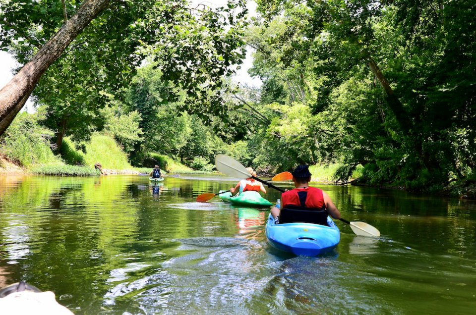
Canoeing Indian Creek
Davy Canupp
Perhaps one of the most overlooked paddling trips in the Huntsville area is to be found on the upper section of Indian Creek in Madison, Alabama. If you live around here, you might be thinking, "You can paddle Indian Creek?" Yes, you can. Well, sort of.
Greenways and Major Roads
Most of the Huntsville and Madison greenways run parallel to creeks and offer mini nature sanctuaries within the city. Ultimately though we want our greenways to connect to other greenways, schools, churches, and the places we work. To do this we must of find a way to traverse major roads which in most cases were designed to take in to consideration only the automobile.
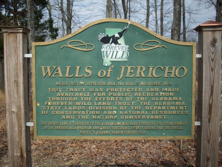
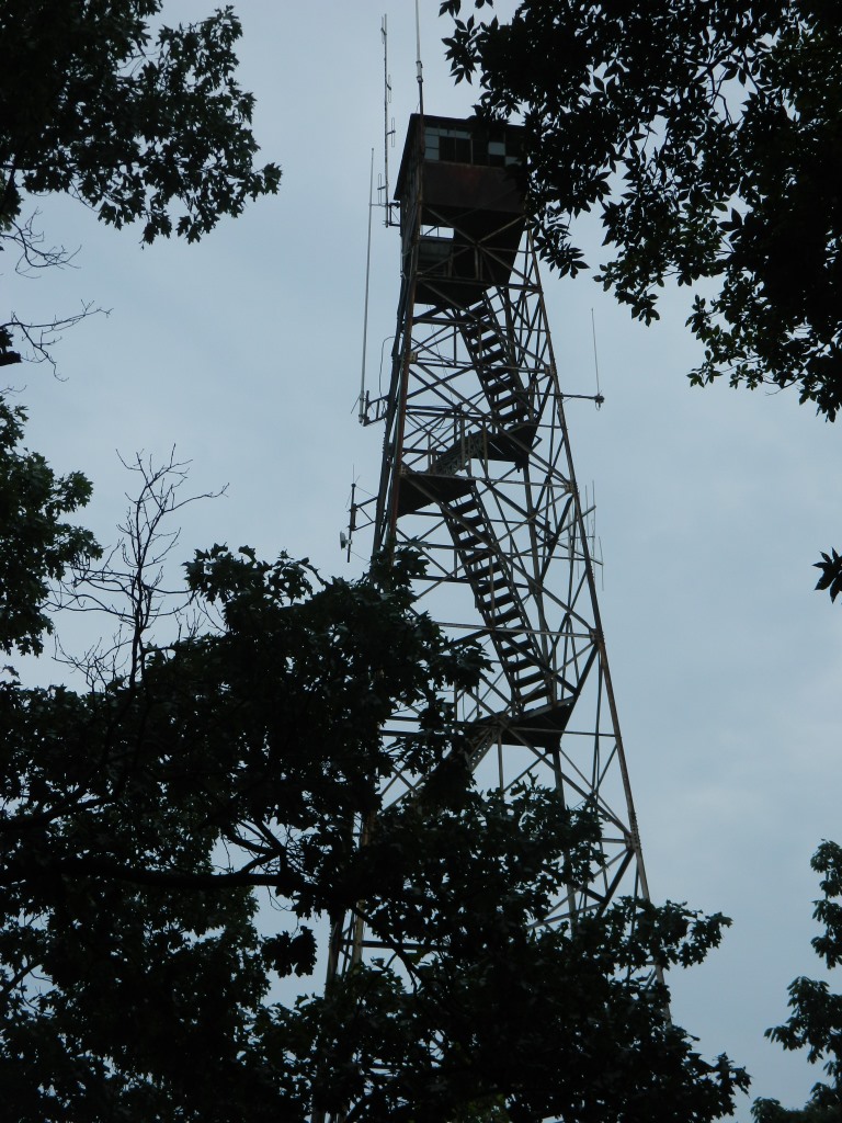
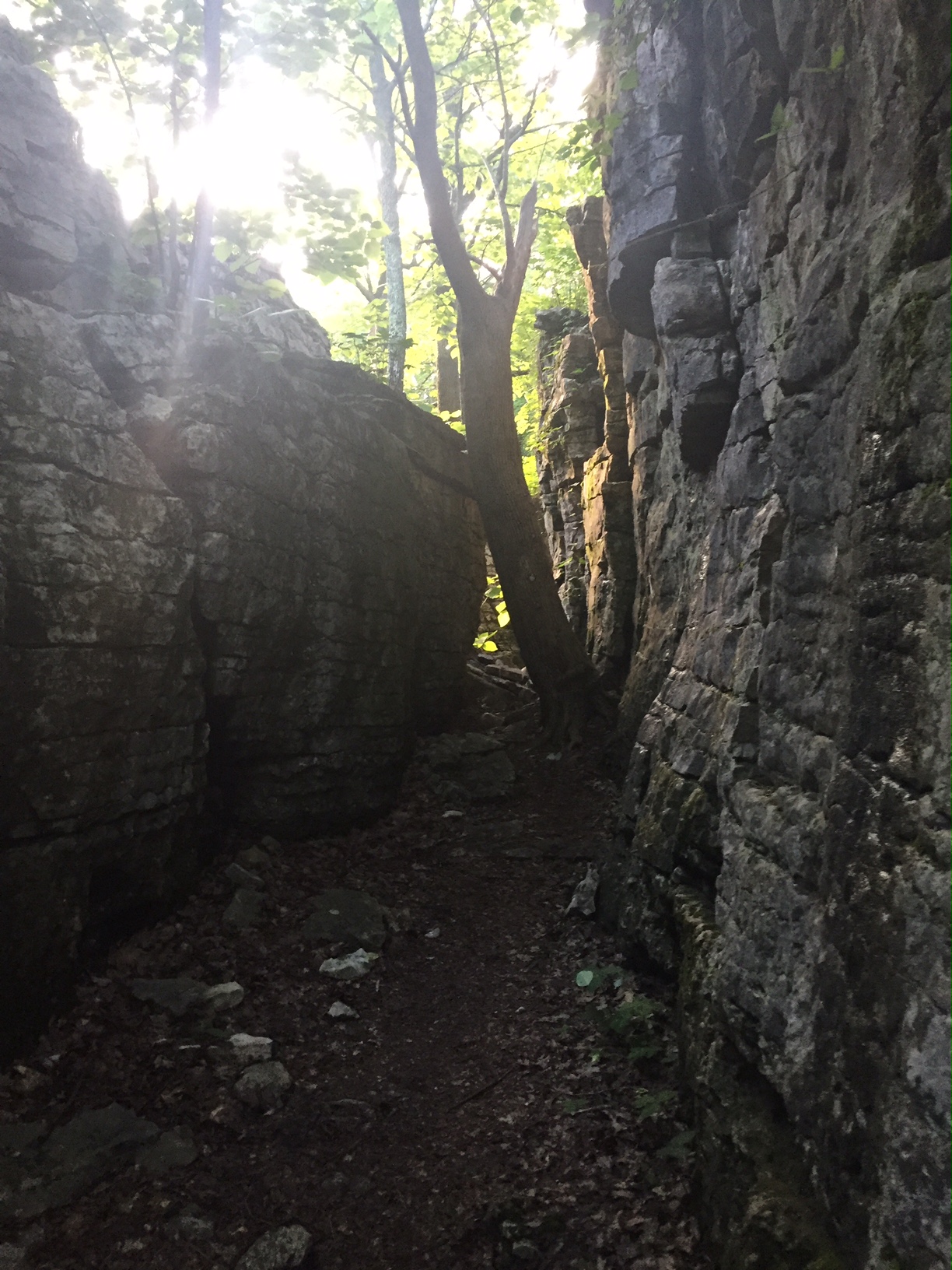
The Walls of Jericho
Across the country, and probably most of the western world, if you mention the Walls of Jericho two images probably come to mind. One is the ancient city of Jericho whose walls fell in dramatic fashion after the Israelites blew their horns. Secondly, some may think of the WWE Superstar Chris Jericho’s devastating finishing move which is aptly named “The Walls of Jericho” which is of course just the Boston Crab. But there is a third image that comes to mind for a few experienced hikers in Northern Alabama and that is the image of towering limestone walls and beautiful waterfalls.
North & South Plateau Loop
From the center of Monte Sano State Park the North and South Plateau Loops act as the main arteries from which all other trails in the park flow.
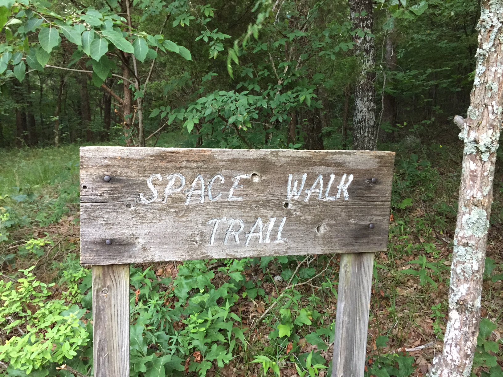
Space Walk
What if I told you that you could once hike from Ditto Landing all the way to Monte Sano is that something you’d be interested in?
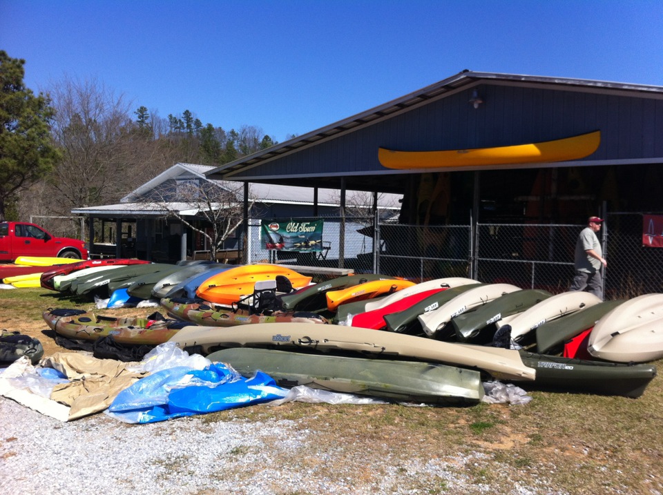
Canoe/Kayaking Outfitter List
Davy Canupp
There are a number of paddling outfitters who offer boat rental and shuttle services for float trips in the northern Alabama / southern Tennessee area. This section of the website is intended to serve as a guide for those who are interested in checking out the beautiful waterways of the region but who don't have a boat or available means of transport.
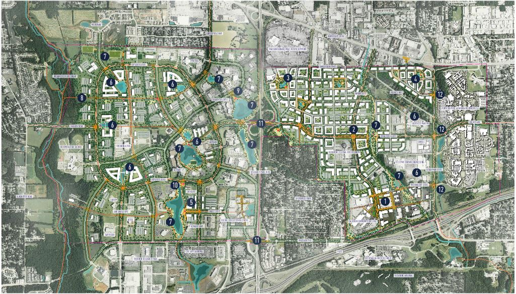
Cummings Research Park
Huntsville's Cummings Research Park (CRP) just dropped their master plan and what it has in store for greenways is awesome.
Research Park is a popular running area and if the newly released master plan comes to fruition its about to get much better. I won't bore you with the details just the highlights.
Here is what the plan says about greenways:
Greenways are recommended open space systems within the park that include natural areas (existing or re-established) that are in contrast to the built environment. The greenway and surrounding undeveloped areas provide the structure for a contiguous system and connects to major destination both internal and external to the district. This area create opportunities for recreation interface with open space.
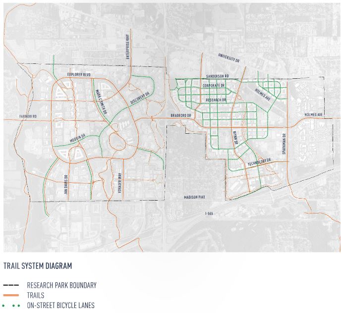
The picture above shows the new and existing trails and greenways in CRP. What we care about the most is what's new:
- Three new connections to Indian Creek Greenway.
- Northern and southern extension of Indian Creek Greenway
- New greenway along Sherwood Creek.
- The northern half of the Mcdonald Creek Greenway from Exploration park.
- Many, many more multiuse trails and bike paths.
To get a better view of the plan go the CRP home page which has links to two documents, the Master Plan and design guidelines that have more info. As always I will be adding this to the Huntsville and Madison Greenways guide ASAP.
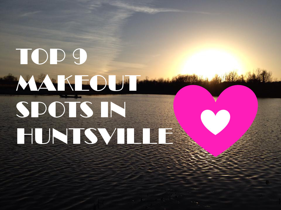
Top 9 Makeout Spots in Huntsville
For reasons that are not entirely clear, Huntsville Outdoors has compiled the following list of makeout spots in the area. Most likely, the majority of our readers have easy access to their own home/apartment/tent in which to get it on. But if you're in the mood to relive your youth, then crank up the ole 4WD pickup (or Jeep) and go experience an American pastime.

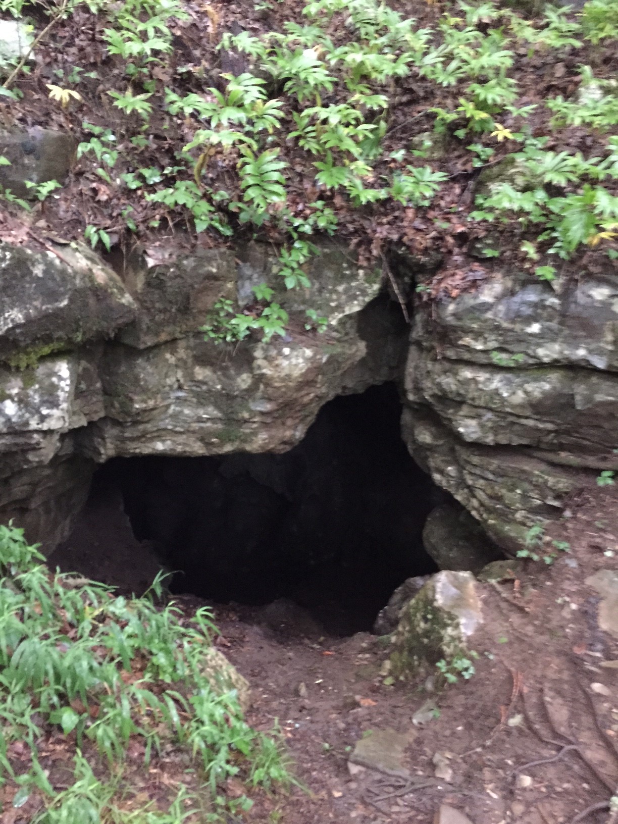
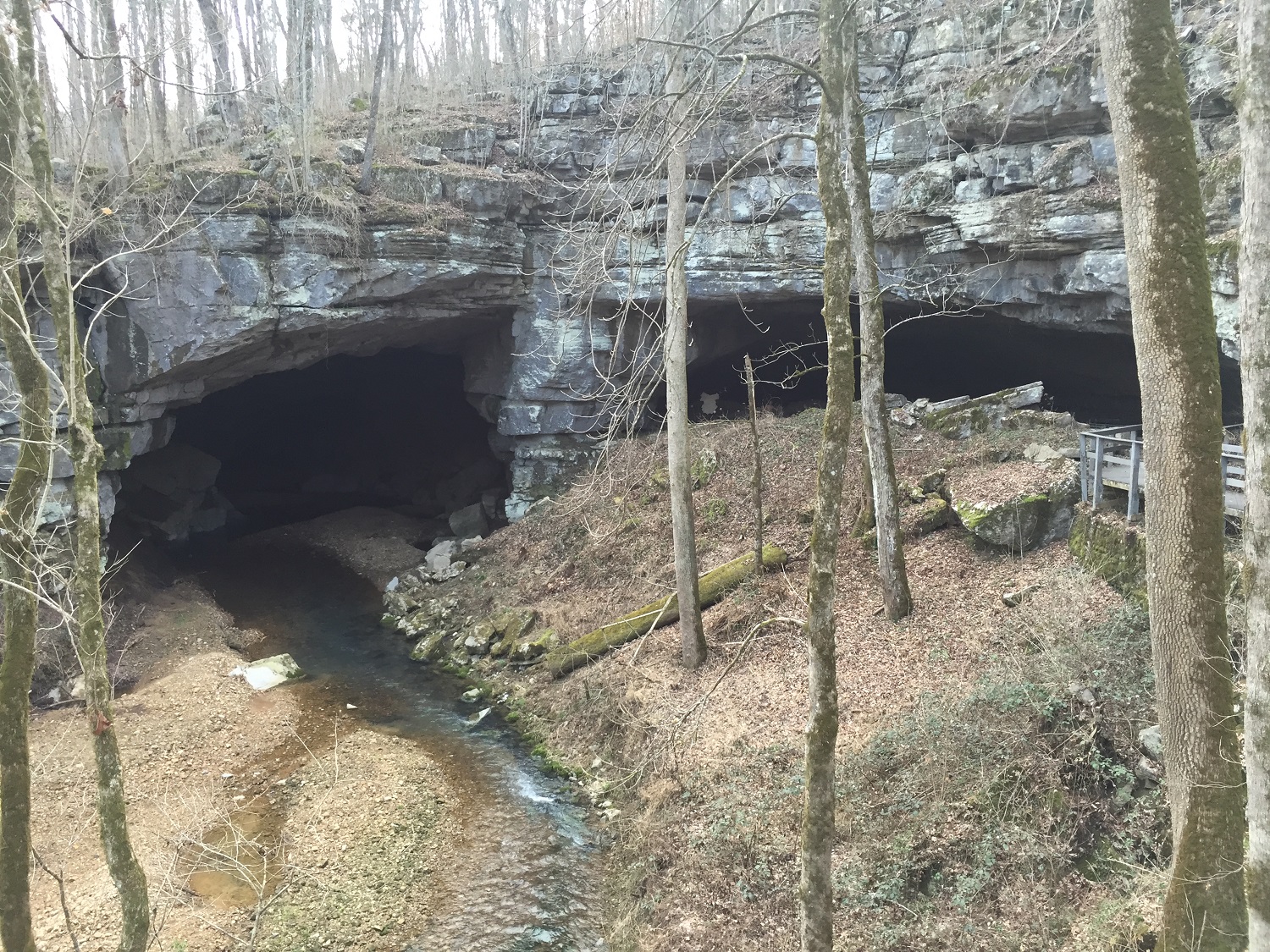
Stephen's Gap
Update 6/16/2015: Stephen's Gap is now a part of the Southeastern Cave Conservancy (SCCi). To access the porperty vist the SSCi Stephen Gap Callahan Cave Preserve page and check out their Visitor Use Plan. We will be planning a trip back out to the cave once the snakes go back into hiberation so check back later for a full update.
After a week of especially heavy rain, I always love going hiking so I can explore and see waterfalls, streams, creeks, and rivers at their peak and in all of their majestic beauty. There is just something about the sound of rushing water, the beauty of the white caps, and the raw power of these rain-gorged water elements that brings out my inner child. Growing up near the Mississippi River, I fondly remember going falls in my hometown as a child and being mesmerized by the constant churning of the water. So when the rains come, it’s great to be in northern Alabama to enjoy the plethora of areas which feature all of the water elements that I love. Stephen’s Gap is no exception.
Getting There
Located right outside of Woodville, Alabama, just off a quiet county road, you can find a gem of a cave called Stephen’s Gap. Click here for the Google map location. Being invited by a good friend to go on hike is no surprise for me, but having never heard of the destination previously is. After some Google Image searching it became even more unfathomable that the local outdoorsman I claim to be had no idea that this gorgeous local treat even existed. It felt like being a part of an exclusive club with a secret handshake and the only way to get to the trail was through secret door behind a bookshelf. Or maybe it was more like stepping into wardrobe and coming out in Narnia?
It can be said that you have to know where you are going to get there. Even in this day and age, with GPS units and the Google Maps iPhone App, you can easily miss the trailhead at Stephen’s Gap if you happen to be the first person there. The problem is there is no parking lot, nor is there really even a trailhead. You’ll have to park on the shoulder of the road and hope for the best as you head through the iron gate, bear left through the muddy roadway, and then take your first right on the closest thing to resembling a trail. You know you’re on the right path if you see random piles of trash and deteriorating piles of shingles. I couldn’t make this up if I tried.
I use the word "trail" very loosely; if you are going for the first time I highly recommend bringing someone who has been there before or there is a good chance you will get lost. There are no markings indicating where to go and the trail is not for novices. It’s very rocky, with wash outs and a small bit of climbing is involved just to get to the cave. About half-way to the Stephen’s Gap, on your left, you will see a small tree spray-painted red (the only trail marking of any kind) indicating a gorge just off to your left that is roughly 50 feet deep and which would be great for repelling into.
As you near the main attraction, you start to hear the sound of the waterfalls. At that point you are 5 short minutes away. The main waterfall starts about 60 feet above and you can easily hike to it. The water is cold, crystal clear, and quite drinkable.
Inside the Cave
The cave itself has two entrances – one for your average hiker and one for avid experienced rock climbing and spelunking enthusiast. A quick Google Image search will show you few pictures of people tying off on one of the many trees above and lowering themselves in. We, of course, took the conventional road more traveled and entered down over the gentle rock slide. I would highly recommend bringing a headlamp, a flashlight, and a dry set of clothes to change into afterwards.


Once inside there is a lot to explore. The most prominent attraction is, of course, the Facebook-profile-picture-worthy platform that boasts an amazing view from beneath the main falls. It’s tricky to get to, and not for the faint of heart since all of the ledges you need to hold on to are very wet and slippery. In fact, the entire cave is slippery, and one wrong misstep could lead to disaster. I was told that many people have fallen and been seriously injured, or in some cases have died.
While exploring, you will find four waterfalls: two that come from the main entrance, one that comes from the ceiling and one located at the back of the cave. This final waterfall allows you to crawl above and explore behind it. Be warned there are bats and spiders; furthermore, people have gotten trapped back there while exploring as a result of sudden rainfall.
The total hike time to the falls is only about 30 minutes, which puts the hike-time-to-awesome ratio off the charts. Overall, I would recommend this hike for any experienced outdoors person who is not afraid to get wet and is looking for an awesome Facebook profile picture.
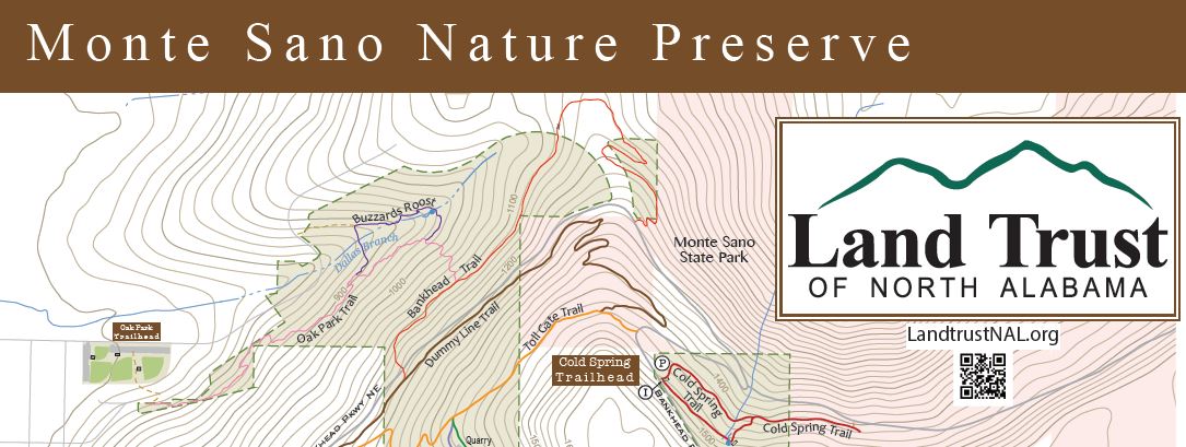
Cold Spring Cave
On Monte Sano Mountain most everyone knows about Natural Well, a 185 foot deep vertical shaft cave, but that isn't the only cave on the mountain.
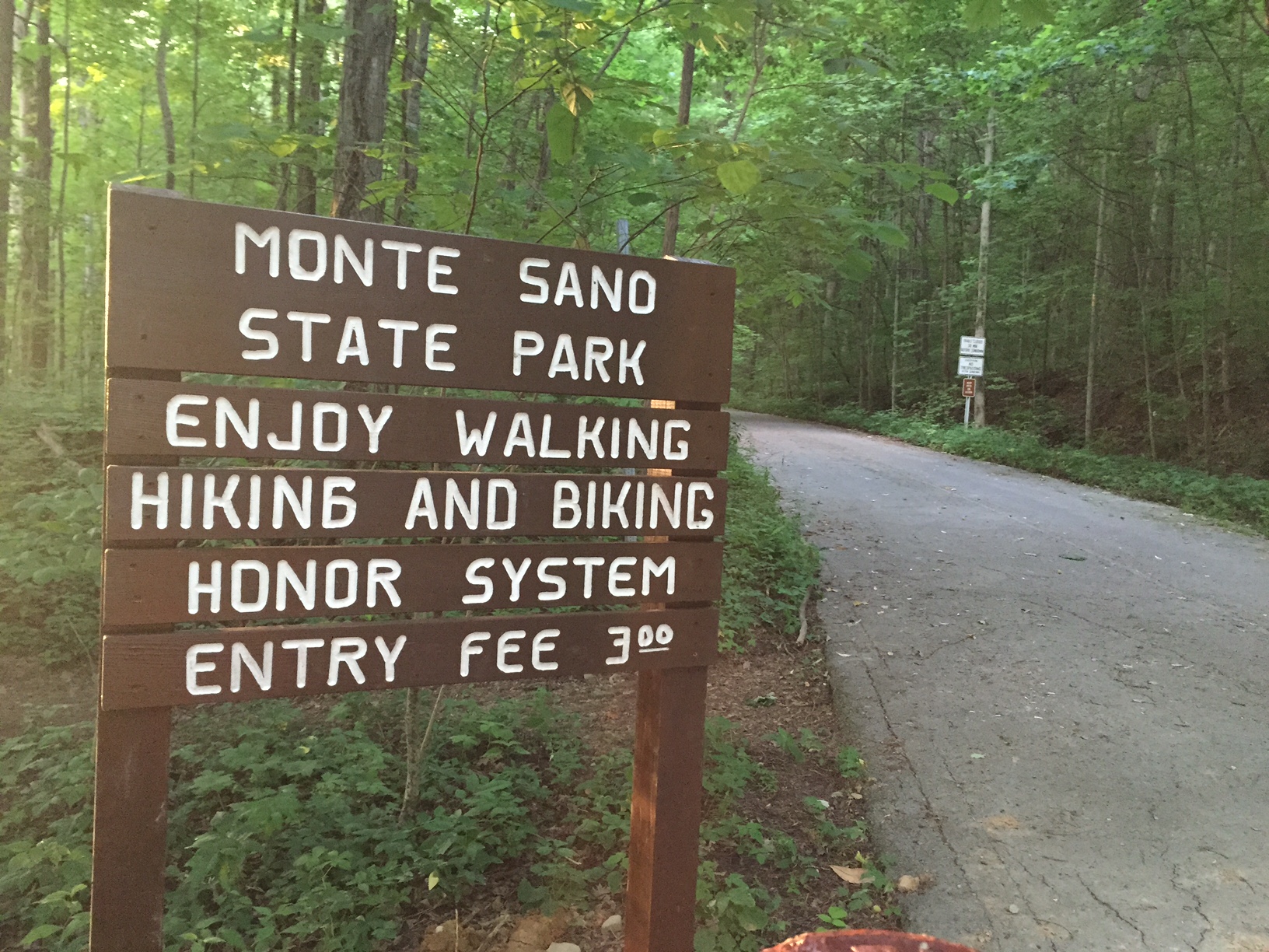
The Monte Sano Trail Guide
Have you ever attempted to find a map of all of the trails on Monte Sano? No? Go ahead and open a new browser window and take minute... What did you find? If you are like me you probably found a map from Monte Sano State Park, a map from the Land Trust, some trails on google maps, and if you dug deep maybe some stuff from Briatech.com. Most of it very good information, some of it's conflicting, and some of it's old. What you didn't find is a one stop shop for it all.
Kayak Buyer's Guide
The following information is updated periodically. Last updated in May 2023.
What to Look For
In the Huntsville area there is very little whitewater unless you're willing to travel an hour or two. Therefore, this guide will focus on kayaks suited for flatwater. There are two major categories of kayaks: sit-inside and sit-on-top. We at Huntsville Outdoors have an assortment of both. Sit-insides will be lower in the water and many have matching skirts to keep water out during rought water. Sit-insides have gained popularity in the last few years.
If you're into fishing, most brands have an "Angler" model or two available. The difference is the addition of rod holders, more secondary stability, and usually more neutral colors.
We're partial to American made stuff but obviously cost is going to be a big factor for many people. Having been kayaking for a few years now, here's some features we recommend be near the top of your wish list:
- Drain plug - good luck getting all the water out of your 'yak without one. And if you store your kayak in your garage like we do, you can pretty much guarantee mildew and an unpleasant smell. Fortunately, there are several aftermarket drain plug kits that install in minutes with a drill and screwdriver. So consider this feature optional when purchasing.
- Cushioned seat - or at the very least a molded seat. If you're planning to take a 6-hour float, your caboose will thank you. Just make sure it's a non-slip seat so you're not sliding all over the place while trying to gain traction in the water.
- Cup holder - trust us--you can't paddle and hold a beer at the same time. There are aftermarket cup holders for kayaks and if you don't mind how you look, a koozie with a neck strap is an inexpensive solution.
- Paddle holder - so you want to take a picture of some redneck's pet raccoon (yes, we've seen it) so you set your paddle on the bow only to watch it slide off into the water as you reach for your camera. The next few seconds determine if you're chasing your paddle downstream or not. Either way, you've missed a golden photo opportunity. I've seen two types of paddle holders: clips that your paddle snaps into and a molded depression on the side of the kayak with bungee straps to hold your paddle in. The molded depression looks nicer and is impossible to damage but requires two hands.
- Foot braces - Helps put more power in your paddle stroke.
Dicks Sporting Goods
Dick's usually has a decent selection of kayaks and frequently has sales. Be sure to check out both locations (one in Bridge Street and one in Jones Valley) as their selection varies between stores. Dick's typically has several sub $300 kayaks for beginners as well as some fishing kayaks. From what I'm told, Dick's will assist with tying a kayak on your car.
At last visit, they were carrying--in order of price--several $150+ Field & Streams, $180+ Lifetimes, $200+ Pelicans and Sun Dolphins, evoke, American-made Perceptions, Vibe, Quest, and some others. They also had some canoes such as the Old Town Saranac and Discovery.
They also have a great selection of kayak paddles.
Academy Sports + Outdoors
Coming soon
Leaf in Creek
Previously the Man Cave, Leaf in Creek opened in May of 2013 in Hampton Cove but moved to Memorial Parkway in 2015. Leaf in Creek serves as the ONLY Jackson Kayak seller in the Huntsville area. I haven't been by in a while but they seem to be specializing in the fishing and hunting models.
REI
Coming soon
Cabela's
Coming soon
Walmart and Sam's Club
In season, Walmart and Sam's Club typically carry 2-3 low-end models perfect for kids. I've only ever seen Lifetime models in the $200-$300 range.
Werner's Trading Company - Cullman
This is truly a store to behold. It's not big, but it's a wonderfully local outfitter for not just kayaks and canoes, but all manner of outdoor apparel and gear. It has a great selection of whitewater kayaks and canoes, with an emphasis on Necky and Old Town, but it's worth checking often because the selection varies. What makes the store really interesting is that in addition to kayaks, they have a top-quality BEER selection, and deal in homebrew supplies, Boy Scout merchandise, and Big Green Eggs. I really encourage a visit to this place, and if you are someone who drives between Huntsville and Birmingham often, I would suggest stopping by every time you go through Cullman. It's less than a mile off the Interstate and always serves as a fun distraction. If you go, be sure to check outside around the back of the store to see the full boat selection -- they only keep a few inside, but there are plenty more in storage.
Terrapin Outdoor Center - Piedmont
You'll just have to visit this place to understand the magnitude of their selection. There are literally hundreds of kayaks scattered around. It's about two hours away from Huntsville but it's definitely worth the drive. The main building houses the more expensive whitewater kayaks and such. Next to it is an indoor/outdoor structure with four rows each probably 40 yards long filled with kayaks. Then there are more kayaks in the front and side yards. Between Davy & I, we've bought 10+ kayaks from these guys. Super nice folks. Did I mention they have great prices too? They may make their money back on the accessories though. I checked a couple prices for life jackets and paddles and found them to be a bit steep personally.
I won't list their selection here because a) it would be too much to list and b) they do a decent job keeping their website updated.
They also offer kayak and canoe rentals with shuttle service if you're interested in a four-mile float trip down Terrapin Creek starting at their shop and ending a short van ride away. It's an easy float and a good duration for a family with kids. This float can get CROWDED.
Bass Pro Shops - Nashville, TN
Bass Pro in Nashville has a typical selection of recreational canoes and kayaks. You certainly aren't going to find exotic brands like Jackson, Liquidlogic, or Necky, but you will find a good number of trusted, popular recreational brands, with a strong emphasis on Old Town boats. That said, the trip to Bass Pro is a fun one even if you elect to get your boat elsewhere. It's such a massive store with so many outdoors items that you can easily waste hours there.
Music City Outdoors - Nashville, TN
This is where you go if you've been kayaking for a while and are ready to step it up. They specialize in high end boats: Crescent, Feelfree, Nucanoe, Hobie, Native, and many more. According to their website, they've got a handful of kayaks under $1,000. The prices go up from there. About half their inventory is over $2,000 maxing out at $5,500. I haven't been to this shop yet but planning a visit soon.
New Land Trust Maps
Unbeknownst to me, the Land Trust released new maps for their five nature preserves back in early September (2015) as well as a new trail app. After comparing what was to what is here are the changes.
Panther Knob Trail
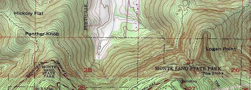
The politicaly correct way to say it is the Panther Knob Trail is geographically challenged. It is not located on or near Panther Knob. It starts from the correctly named Logan Point Trail and summits Logan Point. This trail needs to talk to Dr. Phil because it has a major identity crisis.
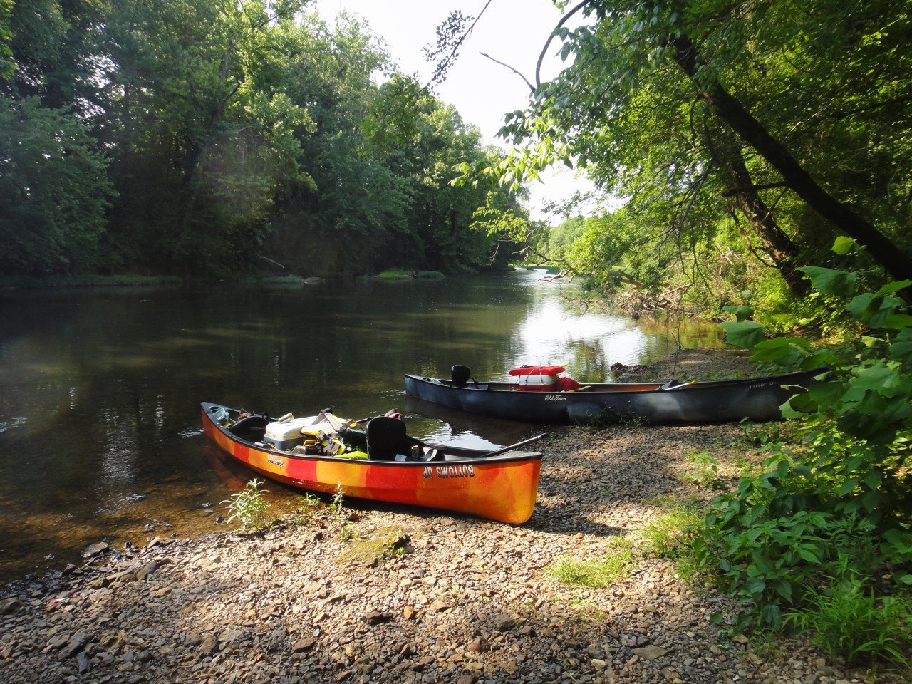
Flint River Canoe/Camping
I've always maintained that canoeing with your significant other is a great way to see how well you work together in tense situations. If you're still talking to each other after a couple hours on the river, you're probably compatible and can go ahead and schedule that second date. Speaking of second dates, why not plan a canoe/camping trip?
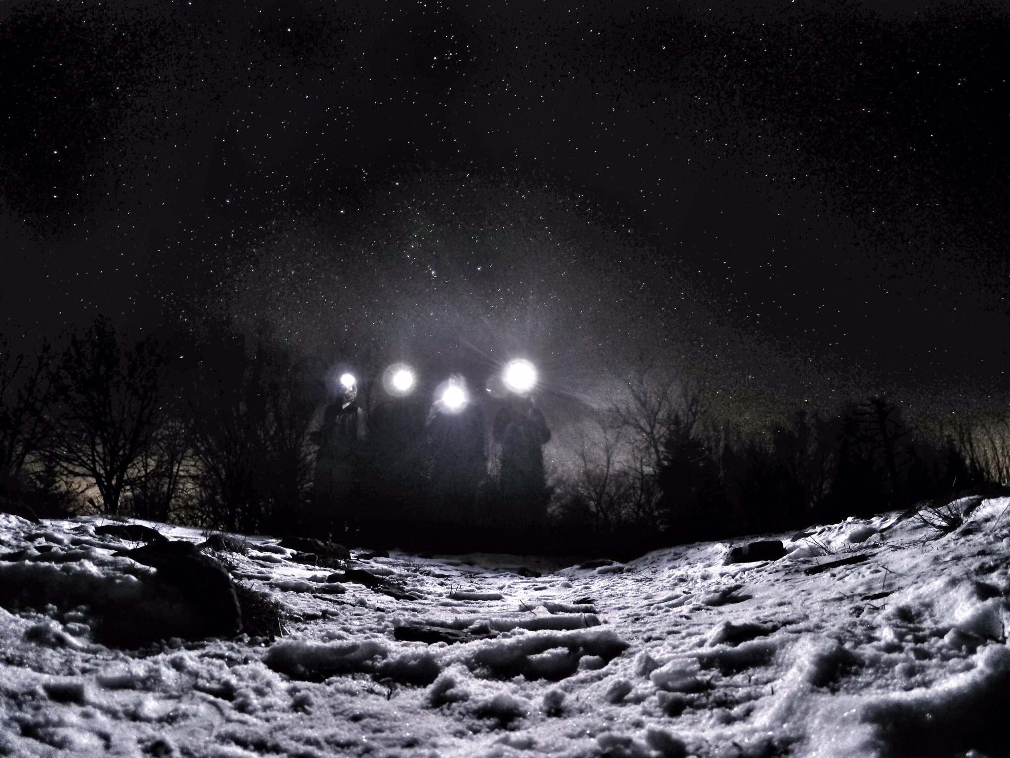
Stargazing in Huntsville Kind of Sucks But There's Hope
I had the opportunity to get far outside the city limits recently and was harshly reminded of how the effects of light pollution cripple our ability to stargaze. Or stated differently, how breathtaking the night sky can be when not muted by all the city lights. The sheer number of stars visible was unbelievable and as my eyes adjusted the longer I watched, the more I could see. Even the hazy gas cloud of the Milky Way was unmistakeable.
Logan Point Trail
Logan Point Trail is the northern most Monte Sano State Park trail that undulates around Logan Point.
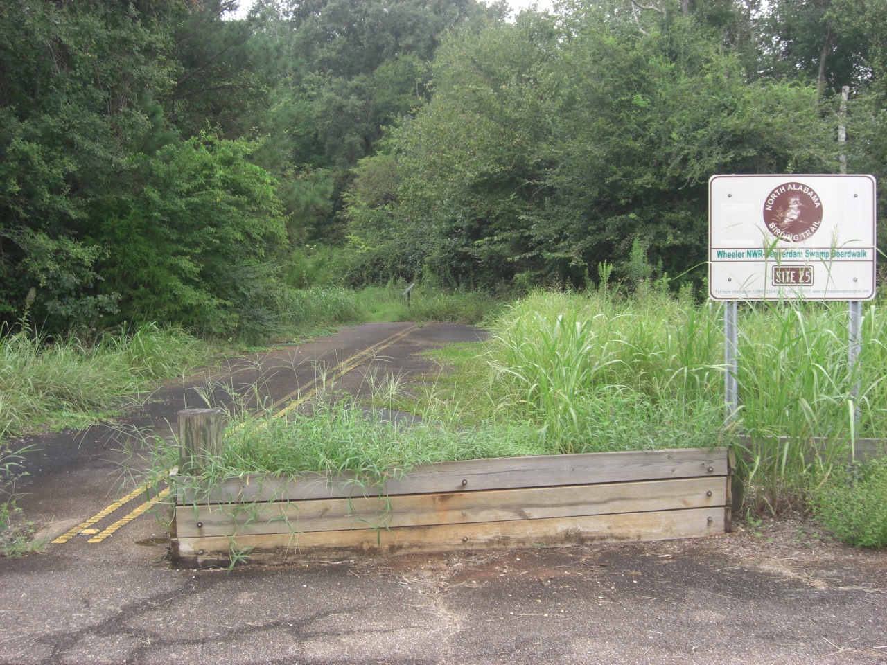
Beaverdam Swamp Boardwalk
I had lived in Huntsville for almost five years before discovering the Beaverdam Swamp boardwalk which is part of Wheeler Wildlife Refuge although at the far eastern edge. The trail is impossible to find unless you know about it and I'll tell you: very few people know about it.
The Wonders of the Cahaba River
Davy Canupp
You may have already known that the Great State of Alabama ranks fifth in the nation in terms of biodiversity, and tops in the U.S. when it comes to the numbers of freshwater fish and mollusks. Well, our ranking appears to be improving a bit more with a recent discovery -- err, re-discovery -- in the beautiful Cahaba River.
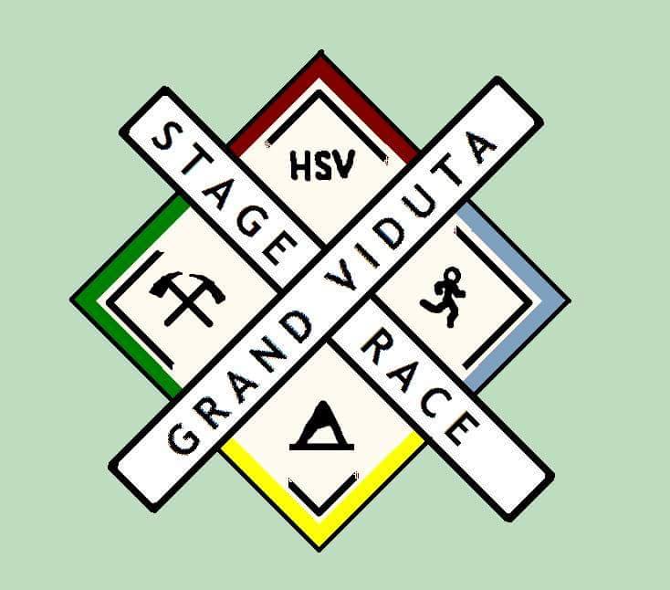
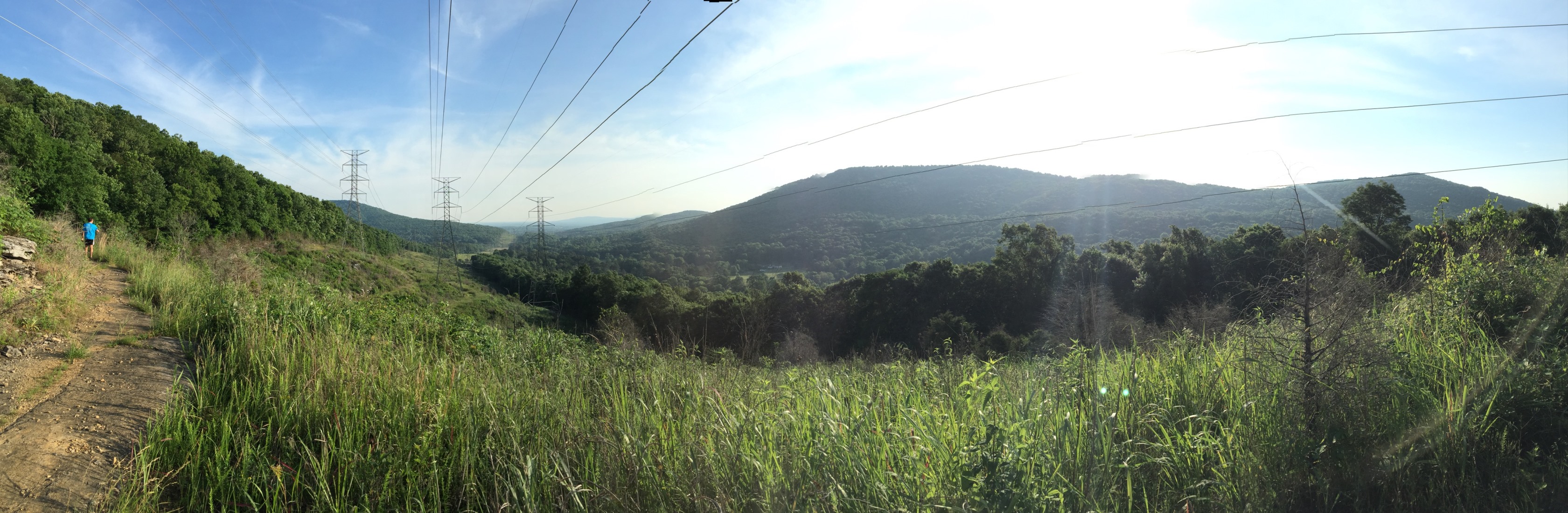
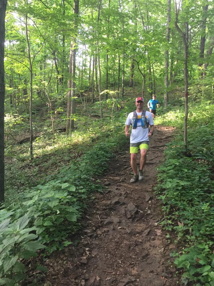
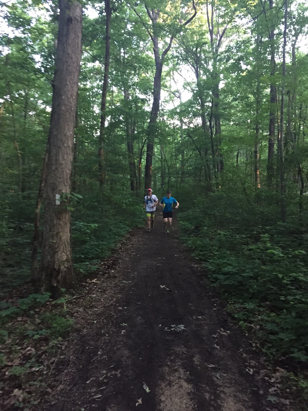
The Grand Viduta Stage Race
Its a burning question on a lot of peoples minds, what is a Viduta and what makes it so grand?

Big Red's Chicken and Waffles
Why is this filed under trip reports you ask? And better yet why is it on an outdoors website? Here's why. Shut up. When you have your own website you can stay loyal to your mission statement. Besides we don't even have a mission statement.
Big Red's Chicken and Waffles opened a little over a week ago and I just happen to have an affection for chicken and waffles. Probably from my trips to Roscoe's in LA.
Russell Cave Home to Massive Cave Parties Circa 7,000 B.C.
Davy Canupp
Admit it. You arrived at this article while Googling "paleo" diets. Yes, yes; you did. We know, because we have Google Analytics. OK? Good, glad you came to terms with that. Now, let's talk for real about what was going on during the Paleo Period, which ran from about 10,000 B.C. to 7,000 B.C. Mostly, a lot of grunting and spearing. Not much farming, but you already knew that. There was, however, a massive cave party just between Scottsboro and Chattanooga.
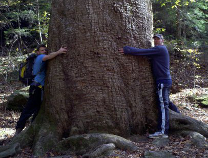
An Easy Hike to See a Really Big Tree
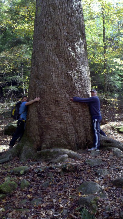
You like trees? How about things that are Big? Then this is the hike for you. Located in the center of the Sipsey Wilderness you can find the largest tree in the southeast aptly named Big Tree. (clever right?) The big tree is a Yellow Poplar approximately 150 feet tall and takes about four grown men to encircle its circumference.
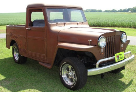
Jeepin' in North Alabam'
Davy Canupp
I am at a loss as to why, but I am one of roughly ten gazillion guys out there who is hopelessly obsessed with owning a JEEP. It’s to the point that I even capitalize the entire name in some sort of weird showing of reverence to the brand, the concept, the ideal. Oh. I’ve got it bad, y’all.
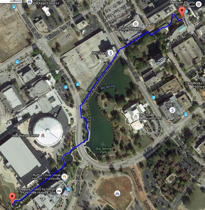
Aldridge Creek Greenway
Key: Blue = Existing Greenway, Purple = Potential/Planned Greenway, Black = Connections
Aldridge Creek was first greenway built by the city of Huntsville and it is the longest, and most used greenway in the city though I have no statistics to back up that last claim. It longest section runs along Aldridge Creek from Ditto Landing ending a 1/4 mile before Weatherly Road on Bailey Cove Raod. The other section know as the Altwood Linear Greenway is 0.89 miles running along Aldridge Creek as well from the North end of the Valley Hill Country Club to Four Mile Post Road. There is a third planned and funded section that runs from Weatherly Road to Eslinger Drive ending at the south side of the Valley Hill Country Club. I do not include the Jones Family park as an unconnected section of the Aldridge creek only because the official city plan doesn't show the greenway going north of Four Mile Post. But for all intensive purposes this can be considered a fourth unconnected section.
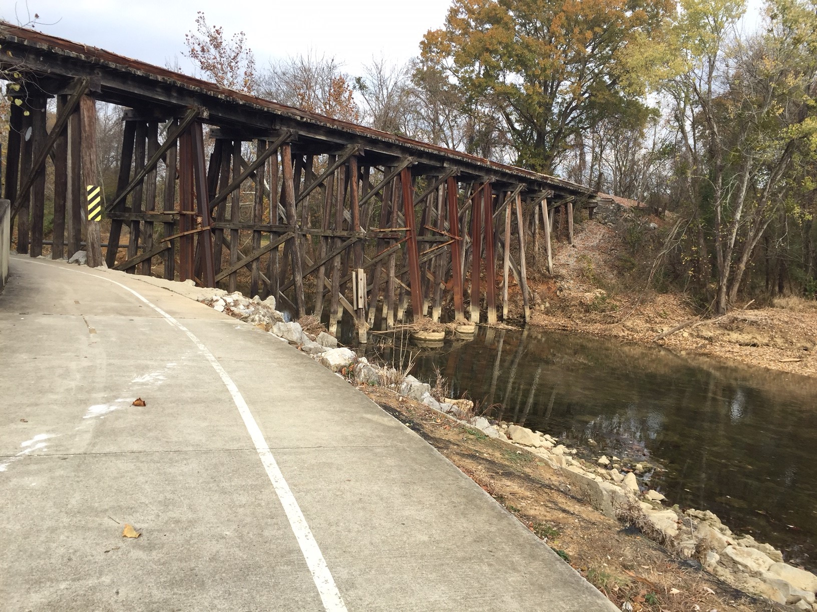
Ditto Landing

In the spring of 2015 the city unveiled their master plan for Ditto Landing which included a lot of good things for runners. As you can see from the picture above the master plans calls for extending its southern end all the way to the Tennessee river and then adding another multiuse path under HWY 431. The plan calls for addtional multiuse paths all around Ditto Land connecting up to the Tennessee River Greenway as well. Future phases of the plan also call for multiuse bike path that goes under US 431 to another undeveloped city owned parcel of land that is earmarked for recreation.
One of the interesting parts of the plan is a new greenway that would branch off to the south using an existing railroad. It has been suggest that this rarely used rail line could be be converted in its entirety into a greenway. If that were to come to furtion it would run from Ditto Landing all the way to Downtown Huntsville.
Connecting the Unconnected
With the anouncement the of the construction of a new segment of greenway from Weatherly to Eslinger the obvious question is what the about that short 1/4 mile from where the main section ends to the new section. In my Greenways: Big Picture article spell it out in more detail but the quick answer is that the relocation of existing utilities and storm drainage is cost prohibitive.
The next big connection hurdle is Valley Hill Country Club who's fairways are preventing a connection to the Altwood Linear Greenway. There are many possible ways to solve this problem none of which I can speak to the feasibiity of. I like the idea of construcing the greenway to go around the primeter of the golf course.
The third and final connection would be to Jones Family Park who's greenway is on the opposite side of AldridgeCreek from the Altwood Linear greenway. With runners and bikers being able to use existing sidewalks to get between the two I don't see this as being a big priority for the city. If and when the Four Mile Post road bridge over the creek gets replaced that may present an opportunity for a pedistrian underpass and connection between the two.
The Huntsvile Outdoors Christmas Wish List
Davy Canupp
Looking for a Christmas gift for your Huntsville Outdoorsman or woman? You are in luck! Just in time for Black Friday, we are proud to offer the official Huntsville Outdoors Christmas Wish List. The List includes outdoors tools, toys and educational materials that we think any true enthusiast will be able to use locally in the wilds of North Alabama. Forgive us for the prices, as we really have tried to focus on the best and coolest as opposed to the most affordable.
So, in no particular order, please peruse the following list of items which we commend to you, our dear readers:
The Tale of Two Connectors - Flat Rock
The Flat Rock Trail is long, remote, lacks trail markers, and connects to very few trails. To add to that degree of difficulty, and confusion for that mater, two of the connecting trails share a name. The Flat Rock Connector.
Huntsville and Madison Greenways
Within the cities of Huntsville and Madison their are numerous greenways open to walkers, runners, and bikers. As our community grows these recreational spaces become more important as they connect people to neighborhoods, schools, work, and parks.
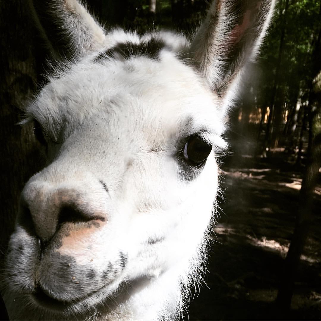
Harmony Park Safari
One of the reasons we started this website was to share discoveries that no one seems to know about. Harmony Park Safari is such a discovery. It's a drive-through safari with goats, deer, zebra, bison, llamas, ponies, emus, wildebeest, zebu, camel, and alligators. The camel and alligators are behind fences but everything else comes right up to your vehicle. Not only are your kids going to love it, but you'll probably have a blast too.
Indian Creek Greenway
Located on the border of Huntsville and Madison and adjacent to Cummings research park Indian Creek is a great greenway for long runs.
Stone Cuts
Limestone formations have created an awesome path that makes the Stone Cuts one of the "Must Do" trails in Monte Sano State Park.
Red Lizard Trail

I am unaware of any species of lizard that is native to Northern Alabama that sports a red hue. In spite of that there is a trail named after this non existent reptile.
Flat Rock Trail
At over 8-1/2 miles long Flat Rock is the longest trail Monte Sano. It features everything from waterfalls, to rock formations, to amazing views.
Sinks Trail
Every time someone mentions the Sinks Trail the first thing that pops into my head is a song by Fountains of Wayne, and no it's not "Stacey's Mom". Rather the song I am referring to is their classic tune "Sink to the Bottom" from their excellent self tittle album. So the next time you find yourself up on Monte Sano be sure to bring your Sony Discman and someone to sink to the bottom with.
Bucca Family Trail
The Bucca Family Trail is an easy flat trail that is perfect for the kids and even grandma. If you were to offer a Monte Sano based trail running degree the entry level course would be titled Bucca Family Trail Running 101.
Natural Well Trail

Natural Well is one of the more challenging and rewarding trails on Monte Sano. Tragically though it has become a victim of erosion.
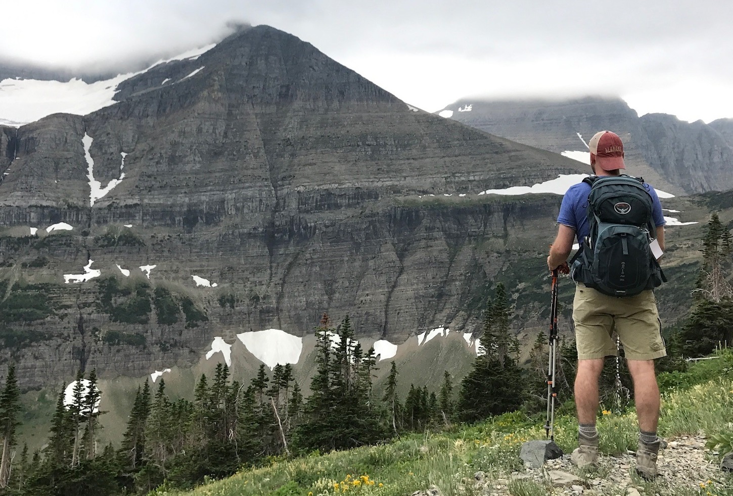
The Trails of Monte Sano
Ed. Note: Huntsville Outdoors is pleased to present its latest feature guest column by former Huntsville resident, and current Washington, D.C., attorney S. Cagle Juhan.
As the weather cools and summer turns to fall, now is a great time to enjoy one of Huntsville’s most underrated and accessible outdoor experiences: the trails of Monte Sano. Over the past year, my girlfriend, Melanie, and I hiked virtually every trail on the mountain and the surrounding area. We encountered an array of wildlife, stumbled upon several natural wonders, and forged lasting memories. And with a little effort, so can you!
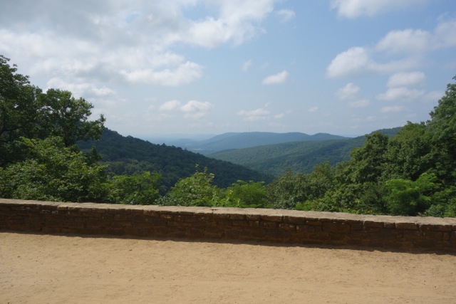
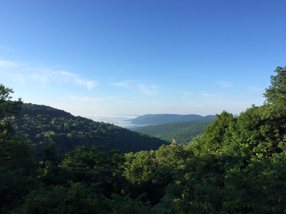
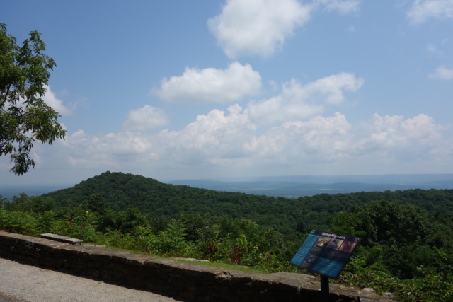
The Hidden Overlook on Monte Sano
If you thought this was the most breathtaking view atop Monte Sano you'd be wrong. Most people are familiar with the above lookout. And many have likely participated in a little video trickery...
Arrowhead Trail
According to Merrian Webster Dictionary a cistern is an artificial reservoir for storing liquids. That was something I did not know until I ran the Arrowhead trail which features a Civil War era cistern. I also learned the tank on your toilet is also called a cistern. Now if I only could figure out what the names of the other parts inside the cistern are called because I am pretty sure that thing-a-ma-bob and what-cha-ma-call-it are not their proper terms.
@huntsvilleoutdoors
All things outdoors in North Alabama.
![]()