Total: 94 results found.
Page 1 of 2
Greenways: Huntsville partners with the Land Trust
In November the City of Huntsville announced a bold but not unprecedented partnership with the Land Trust of North Alabama to assist the city in growing its greenway network.
West Huntsville Receives Much Needed Nature Preserve
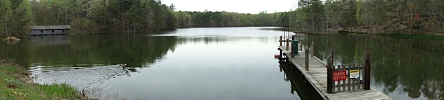
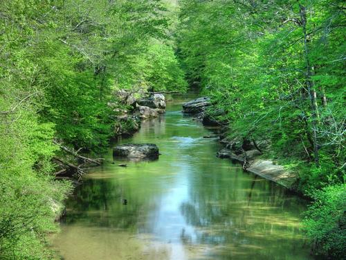
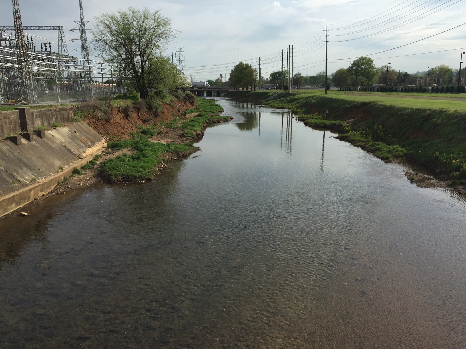
With the opening of the Dallas Fanning Nature Preserve on Wednesday, the city of Huntsville made its long-awaited first step toward providing greenspace to the westernmost side of Huntsville. Major growth over the past 20 years in the area west of Redstone Arsenal made this investment by the city well overdue.  The Dallas Fanning Nature Preserve is named after the late retired General and former Director of Urban Development who pushed for western expansion and is credited/blamed for land-locking Madison city through annexations. In 2008, he was also responsible for procuring this land which was being used to harvest topsoil and dump construction waste for the surrounding developments.
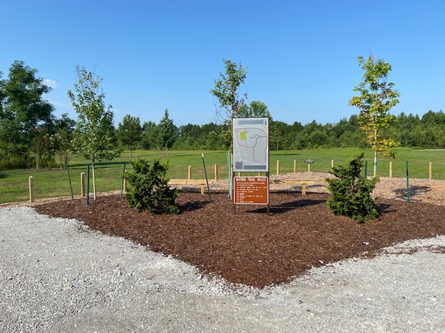
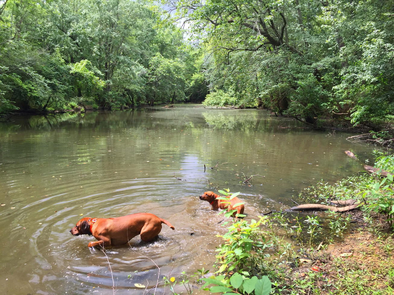
The Preserve boasts 58 acres of trails, benches, and 400 newly planted trees. It is the first new preserve in Huntsville since the Chapman Mountain Nature Preserve opened in 2018. The Preserve was built over six months ago and chained closed until this week when Mayor Battle hosted a ribbon cutting ceremony. Nearby residents were discussing it online as early as December but the city was mum on its purpose. District 5 Councilman Will Culver was asked via Facebook and email about its use but no response was given. I guess everyone loves a mystery. 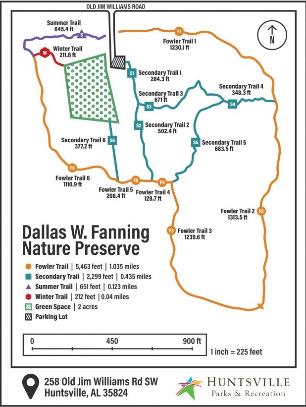
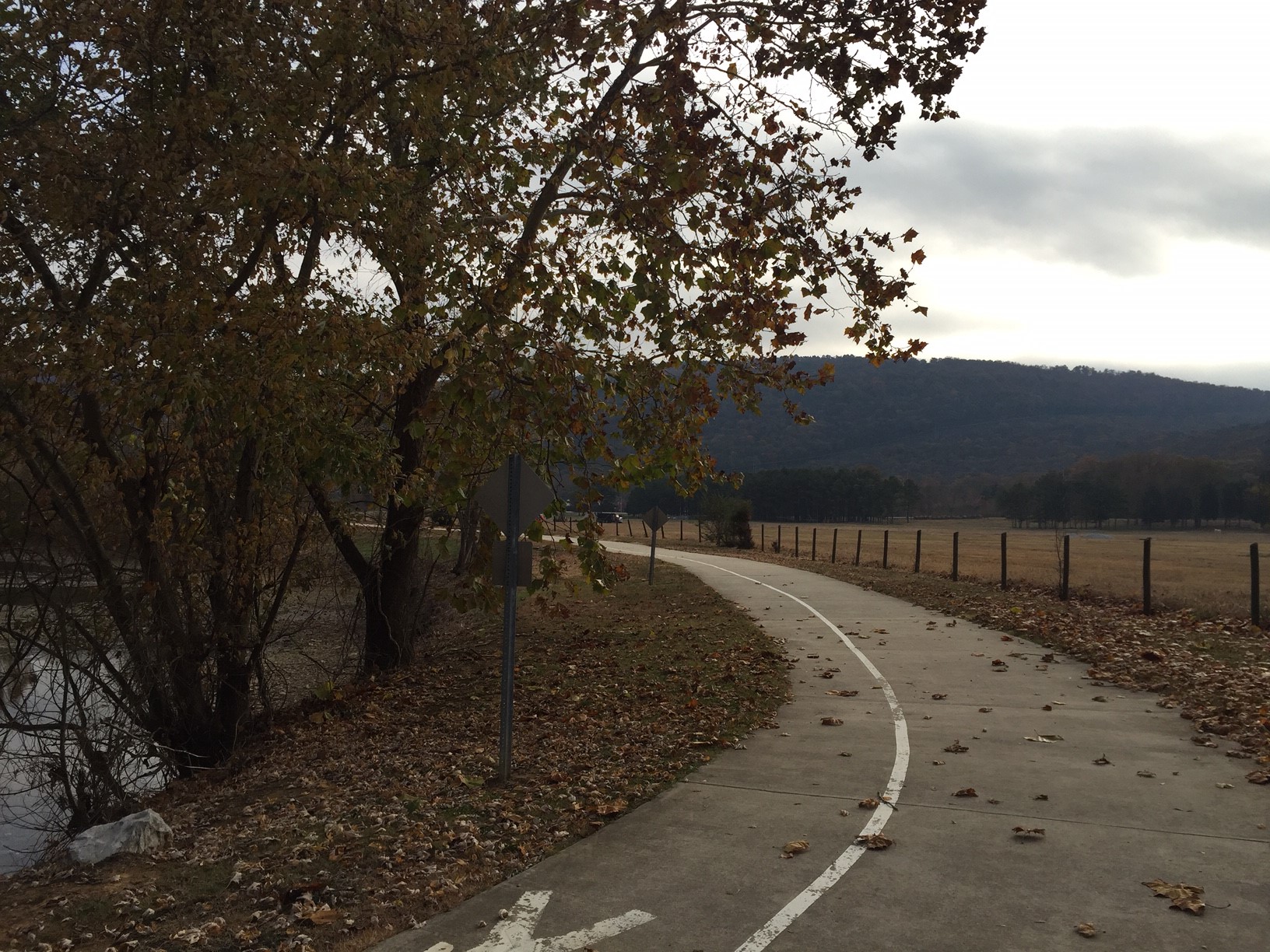
Huntsville Outdoors made its first "official" visit to the area on Saturday to get a first-hand look although we did take a peek back in December. As mentioned during the ribbon cutting ceremony, the preserve was done on a budget and consists of gravel parking, trails, signage, and no lighting, playground, dog waste stations, or restrooms.  Because the preserve is in a low-lying wetland area, much of the 1.7 miles of trails were raised using gravel and covered with soft mulch. The trails that were not raised such as the Purple Trail were extremely muddy on this particular day keeping in mind there has been significant rain during the past week. We went at 9am and were likely the first visitors of the day as evidenced by the number of spiderwebs we cleared. We were also harrassed by aggressive flies during most of the hike around the outer trail. The outer trail, named after Steve Fowler who architected the preserve and built the benches, runs parallel to Old Jim Williams Road for quite a ways with a nice buffer of trees to block the occasional traffic.
 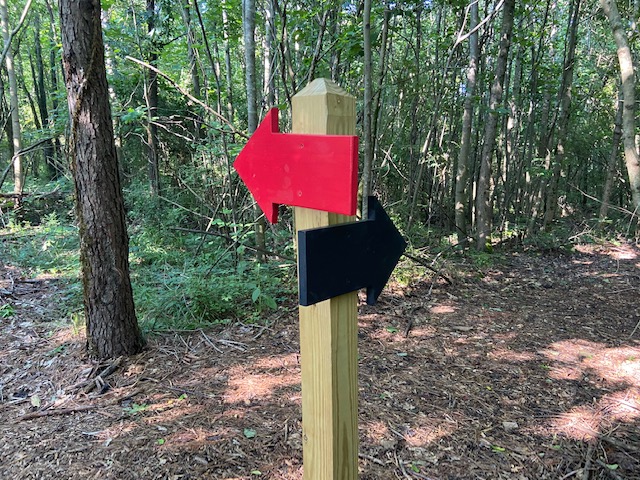 A smattering of wildflowers provides a glimpse of what it will look like in Spring. Surprisingly, the Summer Trail is currently closed. The trails are very well marked with large painted arrows referencing the trail colors on the map.


Judging by the other visitors we saw arrive as well as comments posted online, the preserve is seeing signicant activity from dog owners. Due to the lack of city amenities on that side of town it makes sense that the city will use the preserve to introduce additional benefits for residents such as a dog park or playground equipment. I have sent that question and others to the city and will include their responses when I receive them.
For those on that side of town looking for other short trails, the Beaverdam Swamp Boardwalk is a little known and peaceful experience. For a more strenuous hike, the Rainbow Mountain trails in Madison offer interesting rock formations, spectacular views, and challenging climbs.

Eric Adams
Eric has been an Editor for Huntsville Outdoors since 2012. His outdoor qualifications include: owning a canoe, enjoying the outdoors, and knowing how to type.

Beware the Lionfish
 Davy Canupp
We've been happy to report recently on multiple species of wildlife now making a home in Alabama. This morning however, the news tells us about the arrival of a species we'd rather not see living here. Apparently State biologists have now confirmed that the Lionfish has arrived near Alabama's Gulf Coast beaches, and we have photographic evidence of one that was killed at Perdido Pass in Orange Beach, Alabama.
Introduction to Mountain Biking in North Alabama
Add this to the list of reasons Huntsville is tops in the State: it's got to be the most convenient city in Alabama if you want to rush out of work at the end of the day and hit the trails for some mountain biking. If you don't know much about the great mountain biking options in the Huntsville area, you've come to the right place. This article will give you a very basic introduction to the local trails and also offer a few suggested day-trip options.
Monte Sano State Park
There's no doubt that Monte Sano State Park is the best local option for mountain biking. If you think about it, Monte Sano is Alabama's most urban state-owned recreational area, situated right in the middle of Huntsville. Birmingham has Oak Mountain State Park, but it's way out of town. Meaher State Park is near Mobile, but it's across the causeway to get there, plus there's no biking to speak of. Lake Lurleen is near Tuscaloosa, and Auburn has Chewalca State Park, but those college towns don't compare to Huntsville in size.
Moreover, the trail options on Monte Sano are really good. My favorite ride right now is to start out at the Land Trust Parking Lot on Tollgate Road and ride up the Mountain along the roughly 1.5 mile Bankhead Trail. It's short, but it's a heck of a good ride and you can FLY on the way back to your car. When you get to the top of the Bankhead Trail, you will find yourself in the curve where Bankhead Parkway ends and Fearn Street begins. A lot of bikers and hikers park here to jump on the closed section of Bankhead Parkway, which shoots rather directly up to the Hidden Lookout at Monte Sano State Park. I usually take a break here and then keep heading up the Mountain via the paved Bankhead Parkway. From the top Hidden Lookout, I then head over to the Bucca Family Trail, a 2.9 mile easy loop that's also a great place to introduce your kids to mountain biking. You can go pretty fast on this trail, and if you want to extend your ride, you can loop back to the paved section of Bankhead Parkway via the longer Montain Mist Trail or a very short (and steep) section of the Sinks Trail. Once back on the paved section of Bankhead, you can then head down the Mountain to the Land Trust Parking area, enjoying that supersonic last mile on the Bankhead Trail.
That's my favorite loop on Monte Sano, but the geography of the Mountain and the number of trails gives you plenty of options to design your own route. The State Park has a nice summary of the trails, with posted lengths and difficulty ratings, here.
Land Trust Trails
The Land Trust of North Alabama allows mountain biking on pretty much all of its properties, and you can find a list here. Most of the good trails are on the Land Trust's Monte Sano property, but you can also get some good rides on the Wade Mountain Preserve, and the newly-opened Chapman Mountain Preserve will eventually feature a closed mountain biking course that will hopefully have some cool features.
Rainbow Mountain is also open to biking, but having hiked it plenty and occasionally poked fun at its offerings, I am a little intimidated. It's rocky and there is a good bit of elevation. I'm sure someone better at mountain biking than me will chime in to tell me if I'm overly cautious, but as of yet, I've not checked it out. Plus, we keep getting lost there.
John Hunt Park (and other City of Huntsville options)
The City of Huntsville is revamping John Hunt Park, and a 4-mile closed course for mountain biking is under construction at the moment. In the meantime, we think it's kosher to ride the cross-country course, but we haven't actually checked with the City on that. It's not the most impressive ride, but it does give you a chance to reflect on how weird it is to have this massive unused recreation area smack in the middle of town. It's also a reminder that our landfill is basically in the middle of our city. We're not sure why you'd want or need a reminder of that, but we are just speaking factually, here.
Speaking of City-owned options, you can technically mountain bike at Hays Nature Preserve, though we think it's more suited for cyclocross biking. Similarly, the City has an impressive Greenway network (about which we have written quite comprehensively). Road biking on the Greenway is a lot of fun, and hopefully the connectively of the Greenway paths will continue to improve.
Wheeler Wildlife Refuge
Not really a mountain biking trail per se, the Refuge is still an absolutely awesome place to do just about anything outdoors. I do a lot of Jeeping there, and a know a lot of people hit Wheeler for fishing, but it's probably one of the best places in Alabama for cyclocross biking. There are two good spots of hop on the miles of dirt road available at Wheeler: follow Greenbriar Road to Jolly-B Road, or head out to Mooresville and start there. If you do head to Mooresville, check out Southern Carnage, a cool little bike shop that caters to local riders.
If you want to learn a little bit more about what makes Wheeler cool, be sure to check out our article on alligators in Limestone Bay.
Day-Trip Destinations
Since Huntsville is basically the center of the universe, there are probably 20 great day-trip spots for mountain biking, but frankly, we haven't tried to count. If you want to count for us, great. We'll make you a featured outdoorsman/woman. If not, just don't insult us in the comments.
Anyway, here's where you should go: the 5-Points Recreation area near Cloudland Canyon State Park, just outside Trenton, Ga. It's an hour and a half to get there, give or take, and the trail options are ridiculous. I recently logged about 15 miles on the Cloudland Connector Trail, which is a great sampling of the options. If you want a little more elevation, it's available, but I was hot enough without the need to climb. I parked at the Ascalon Trailhead and took off from there, but you can also choose to park either inside the State Park or at the Hinkle Road Trailhead.
Another option, which gets a lot more publicity, is a Forever Wild property called Coldwater Mountain. The official website is kinda weak, but here's a really good summary of the trial offerings. And here's another link to get you the information you need to plan a day trip. Wherever you get your information, the important thing to know is that Coldwater Mountain has about 35 miles of trails (eventually there will be 60 miles) - plenty for a long day. And it's being touted as an internationally-recognized destination for great biking. All of this just outside Anniston, which is around 2 hours and 20 minutes away.
Finally, consider checking out Duck River Recreation Area, which is owned by Cullman Utilities. A rudimentary trail map is located here. It's a flowing, single-track trail somewhat similar to Cloudland Canyon, with less elevation. The climbs are short and the downhills are quick. The trail is a hard-pack clay with minimal rocks and roots, definitely different from Monte Sano. And you get some cool views of the reservior because the trail runs all the way around the edge of the lake.
Overnight Trips
Obviously, if you are willing to go overnight, you can go anywhere. But two good options are Chewacla State Park and Oak Mountain State Park. Oak Mountain is south of Birmingham and has plenty of good trails, including the Fire Trail, which is where I got my introduction to mountain biking as a high school student from Homewood. (Speaking of my younger years, Oak Mountain has a really fun BMX course that I used to hit all the time growing up). Here's a link that will get you to a trail map. The cool thing about hitting Oak Mountain is that there are camping options inside the park and you can basically ride your bike on park roads to all of the trailheads.
If you want to go a little further away than Birmingham, or perhaps want to catch a football game down in Auburn, try out Chewacla. The trails range from 0.5 miles to 8 miles, and there is a crazy, 92' foot long bridge you can ride over. The park is also right on the edge of town, and is a popular place to stay during football season. If you go, I'd highly recommend renting one of the refurbished 1930s era Civilian Conservation Corps cabins. You can hop on a trail right outside your front door, and it's close enough to town you can finish the day at Niffers.
Ready to Ride but Need a Bike?
Ready to start riding but in need of a bike? There are some great stores around, but my two favorites are Blevins Bicycle Company, in south Huntsville, and Cahaba Cycles in Homewood. Matt Blevins grew up in Huntsville and opened his own shop a few years back. Cahaba Cycles is included because it's in my home town and I bought my first bike there in the 1980s, when they did lawnmower repairs through the back door.
Davy Canupp
Hays Nature Preserve Trail
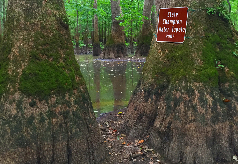
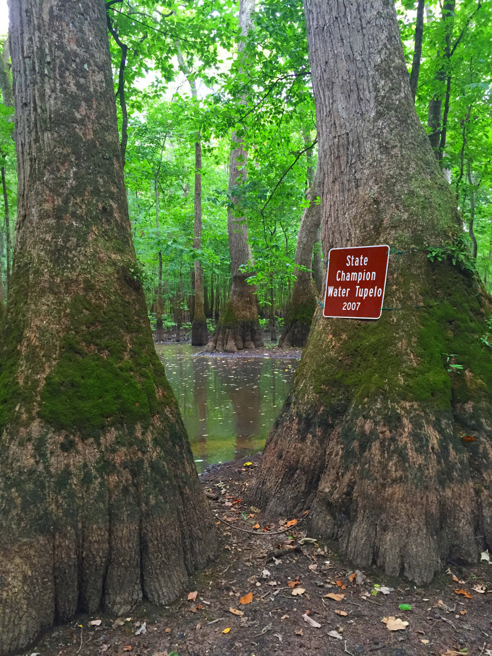
Looking for a short, uncrowded hike that includes thick woods, a rolling river, even a boardwalk thru giant tupelo trees? Plus scads of wildlife—herons, deer, turtles, even river otters? Not to mention dog-friendly?
I hate to spill the beans on one my favorite 1-milers-- the Hays Nature Preserve in Huntsville’s Hampton Cove area-- but I will. This one is not on the nicely-paved Hampton Cove / Flint River greenways. This hike is on dirt trails that get muddy.
From the parking lot at the end of the drive, head for Picnic Point. Do not take the paved greenway & bridge over the Flint River (although that’s a great walk, too.) After crossing a small wet oxbow, you’ll be at a wide open space along the Flint River. It’s a great spot for fishing, birdwatching, or just throwing up a hammock and snoozing. I watched a Great Blue Heron spear a shiny 6” bass in the grass earlier this week.
I always follow the river until the trail ends at Hampton Cove Golf Course, then double back to the winding Beaver Dam Run trail. You may see beavers although they mostly work at night. Rabbits, deer, turtles and raccoons are common along Glass Lake, which is actually an old oxbow where the Flint River used to flow. A yearling doe jumped in the water and swam across the lake while I watched.
At this point, Beaver Dam Run turns into the Tupelo Tree Path. Monster tupelo gum trees have been preserved in a small swamp, including the state champion, a real whopper. Lots of owls and woodpeckers reside here.
A bit further there’s a long boardwalk—over wet swamp most of the time, dry in late summer. Eventually you’ll hit the paved greenway path; take it back to the parking lot.
Even though it’s only a mile, I usually take an hour or so to run my two hounds (off leash when no one’s around) and admire the wildly-diverse habitat so close to civilization. One of Huntsville’s real gems.
Besides hiking, the trail is open to mountain bikes and horses. It’s also part of the Alabama Birding Trail.
Getting There
- Take S. US 431 east of Huntsville
- Turn left past mile marker 324
- Link to Trail Map (PDF)

Mike Dalen
Mike Dalen is an avid hiker, so-so mountain biker & kayaker. Preserving wild lands in Madison County for future generations is my passion. That’s why I’m a volunteer with The Land Trust of North Alabama.
Keel Mountain and the Lost Sinks
Just a short drive from Hampton Cove, the Land Trust of North Alabama and the Nature Conservancy have partnered to protect the Keel Mountain Nature Preserve where you will find a hidden gem hiking trail known as the Lost Sinks.
Wade Mountain
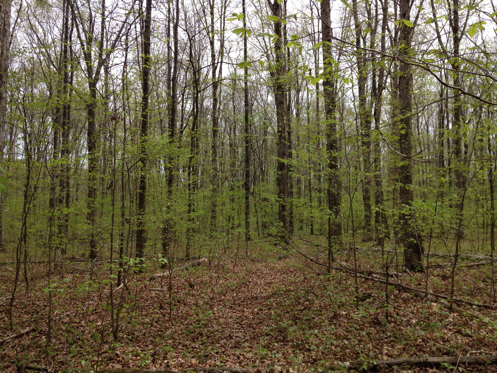
Everyone take a minute. Just exhale. Spit out all that stress that has been over-pressurizing your lungs, quickening your breath, tightening your chest. Take a look at the freshness of the spring forest, pictured above. Dote on the unmistakable harlequin burst of the April woods. Contrast the vitality of the newborn leaflets with the obsolescence of the fallow-colored leaves resting on the warming forest floor. Ponder the synergies and symmetry of nature: the old feeding the new, the dead nourishing the living, the trees lending shelter and filtering the air for the inhabitants of the Earth. Imagine the complexity of our planet. Imagine the vastness of the cosmos beyond. Admire for a moment the miracle of life.
Trail Running on Wade Mountain
Wade Mountain is a hidden trail running gem located in North Huntsville 11 different trails spanning 10 Miles (11 if you count the greenway).
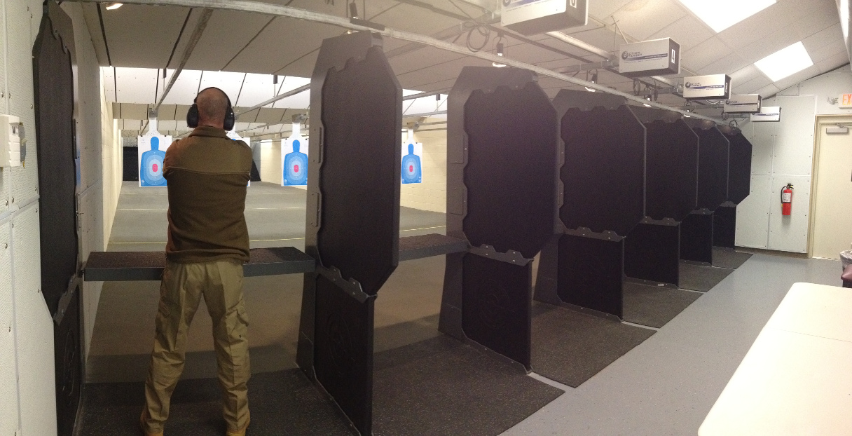
Local Shooting Ranges
So you just bought a new gun at Larry's and already burned through your free pass at their indoor range. There are actually several other shooting ranges nearby and we'll give you the inside scoop on each of them. We've also put together a map showing their locations. Some of the ranges are out of the way so you'll thank us for the map.
Bow-Hunting on Wheeler Wildlife Refuge
There is a point at the end of every summer where you can feel a certain crispness in the air. The days are getting shorter, and the leaves on the trees are starting to show a hint of brown. This time of year signifies a number of things to me, such as football, crankbait fishing on Guntersville, chili, and last but definitely not least, bow-hunting. Without fail, the first morning when I feel the crispness in the air, I think back on my younger years deer hunting with friends on the Wheeler Wildlife Refuge, or “the Refuge” as my friends and I have always called it, and smile.
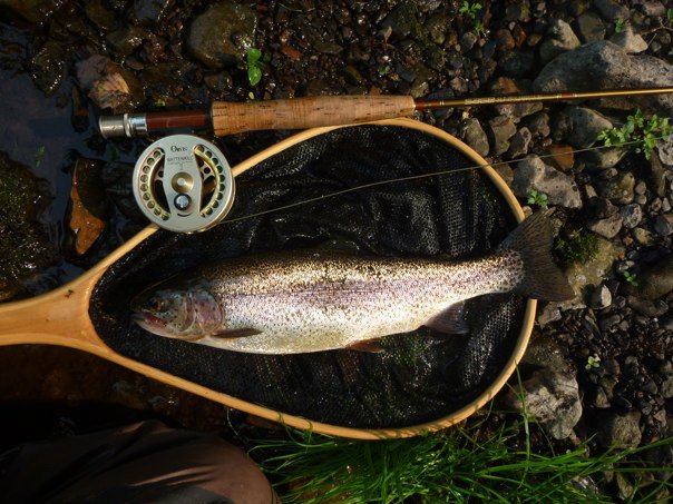
Fly Fishing in North Alabama
Huntsville Outdoors is pleased to present this article by guest columnist Robert C. Lockwood:
Most people associate fly fishing with trout fishing. When the sport really got popular about 20 years ago, with the release of "A River Runs Through It," that was a pretty accurate perception. And don't get me wrong … I love to fly fish for trout. But, the fact of the matter is that the vast majority of water in North Alabama is simply too warm to support trout, which thrive in temperatures that don't exceed 75 degrees. Don't despair, though, because Huntsville Outdoors has all the information you need to fly fish in the North Alabama area, even for trout.
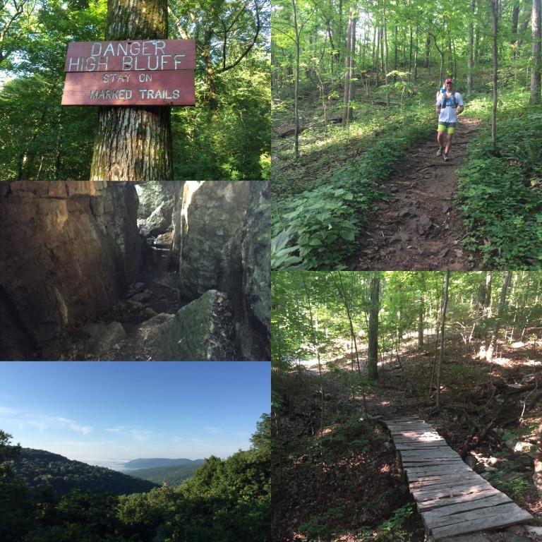
Top Five Huntsville Trails
With the Fourth of July fast approaching we have complied a list of what we consider the top five trails in the area for you to enjoy during the three day weekend.
The Cave Under the Courthouse
Davy Canupp
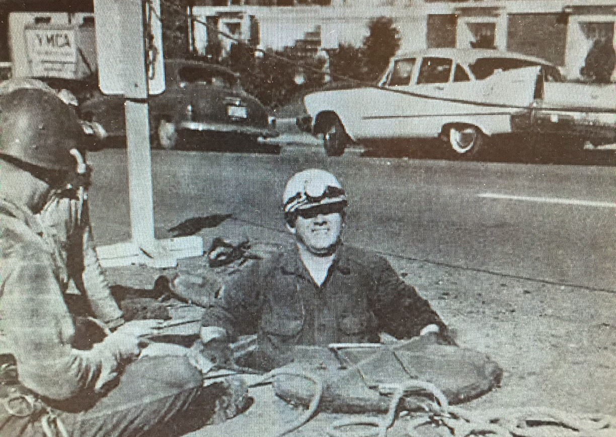
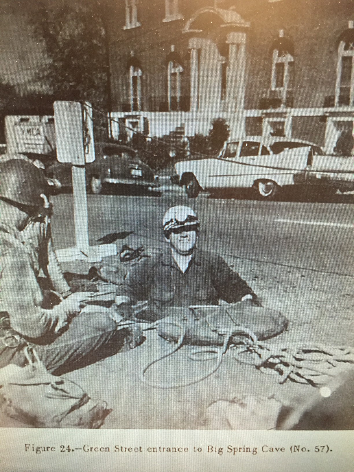
If you are a longtime Huntsville Outdoors reader, you will know that Huntsville was "the Cave City" before it became "the Rocket City." If you also like to geek out on Huntsville's geology, you might know that the Madison County Courthouse is literally built on top of Big Spring Cave, and that the water that feeds Big Spring originates from inside the Cave.
Precious few people have actually been inside Big Spring Cave, though. Our quest to meet someone who has been in the Cave led us to a Huntsville legend, Ray Jones. Son of the locally famous Carl T. Jones, Ray Jones grew up on Jones Farm and has worked the family business here in Huntsville since the 1950s. In 1964, Ray Jones worked at G.W. Jones & Sons, a civil engineering firm in Huntsville. His father, Carl Jones, was the principal of the business, while another well-known family member, Walter B. Jones, served for a time as Alabama's State Geologist.
In 1964 when Ray Jones entered Big Spring Cave, Madison County was planning to replace its iconic, Greek Revival 1914 county courthouse with the universally-despised, eight-story excuse for modern art that occupies the center of Huntsville today. The County hired G.W. Jones and Sons to survey the inside of Big Spring Cave and ensure that it could tolerate the tremedous weight of a 1960s skyscraper. Ray Jones led a 6-man survey team inside the cave and spent 3 weeks there with them, meticulously measuring and exploring the cave's boundaries so that drawings could be created.
Huntsville Outdoors editor Davy Canupp sat down with Ray Jones not long ago to discuss what Ray found in the cave, and also to look over the 1960s era topographic maps that were created based upon his surveys. Ray tells us he entered the Cave from just above the Big Spring, just on the edge of Big Spring Park, through what is now basically a doorway that has been sealed shut to keep kids out. When Ray and his team surveyed the Cave, which Ray says is actually more of a "fissure," they knew there had been a prior survey in the 1930s.
The reason for the 1930s era survey? It's creepy. There was a Yellow Fever outbreak in Huntsville in the 1930s, and many of the locals believed that fluids leaking from bodies in Maple Hill Cemetery was migrating through the Cave into the groundwater at Big Spring, which was then being, uhhh...consumed by citizens. The goal of the original survey was to investigate this possibility and determine whether the water could be diverted. Of course, by the 1960s survey, Ray and his team knew the real culprit was mosquitos, not leaky dead people, so they were not too concerned about swimming through infected bodily fluids. That said, they did encounter waist deep water that they often had to crawl through. They also found old whiskey bottles and newspapers dated from the 1930s, relics from the previous Yellow Fever survey.
Ray tells us that once the 1960s survey team made their way through the tunnels, they used a rope ladder and built a cat walk to facilitate better access throughout the Cave. Eventually, they to reach the floor of the Cave, where they found themselves in a huge room approximately under Jefferson Street, with a ceiling that reached up soared 60 feet or so up, nearing touching the bottom of the street. They also found evidence of a second cave system that appeared to connect in some manner to the Big Spring Cave. They encountered cave beetles that have been located in only two caves in Madison County, one of which is actually pretty far away from Big Spring Cave, leading the team to conclude that the two are actually connected in some manner.
Inside the big room, the survey team noted the limestone ceiling was cracked and unstable. The entire Cave was full of shattered rock, boulders of all shapes and sizes, limesinks and a lot of water. According to the Geological Report signed by Dr. Walter B. Jones in 1964, a copy of which has been supplied to Huntsville Outdoors, "this is the most dangerous cave that this Writer has ever seen, and he has been in about 500 caves in this country and abroad." Enough to convince us not to enter, anyway.
That said, it's only a little bit of a secret that the Cave can still be accessed today through a manhole entrance on Green Street between Randolph and Eustis, across from the old YMCA building. We're pretty sure it would be illegal to use this access hole, but assuming you did, we think you could travel easily to the Big Spring Pond, and perhaps a good distance in the opposite direction toward Maple Hill Cemetery. But we definitely wouldn't recommend it.
Mountains of Madison County Part Three
The final piece of our three-part Mountains of Madison County series. I hope you've enjoyed the series as much as I've enjoyed researching and writing it. For the sake of brevity, I intentionally kept details about the mountains high level but if you found any of the factoids particularly interesting, I encourage you to branch off and do additional research--I certainly did. At some point, I will go back and combine the three parts into a single article and clean it up a little. So without further adieu...
Downtown & South Huntsville
Monte Sano Mountain - 1,620 ft
Scholars believe the translation of Monte Sano was lost at sea but theorize that it is German for "a whale's mountain". And for those who haven't seen the movie Anchorman, that's obviously not true; but what is true and most locals can tell you is that Monte Sano is Spanish for "mountain of health" due to its unspoiled air and clean mineral springs. In 1887, the 233-room Hotel Monte Sano health resort opened. It promptly closed in 1900 (sad trombone).
The most frequented trails in Huntsville are all located on Monte Sano such as Mountain Mist, McKay Hollow, and the North Plateau and South Plateau Loops. The Von Braun Astronomical Society also operates a planetarium on the mountain near the State Park campground.
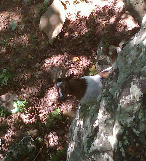
No respectable description of Monte Sano would be complete without at least mentioning the feral goats. Plus, goats are so du jour right now. Often dismissed as an urban legend, hikers frequently report wild goat sightings. Hiking the northeast slope of the mountain near "Golan Heights" will give you the best opportunity of glimpsing the herd. We've received several "confirmations" of the goats but have no photographic evidence to provide other than this image posted to Flickr that claims to have been taken on Monte Sano. Apparently they were domesticated at some point before either escaping or being abandoned.
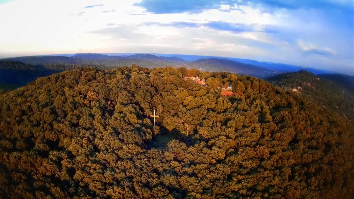
Round Top Mountain - 1,585 ft
Round Top is really just the southwestern knub, or plateau, of Monte Sano. It's where the Burritt Museum, Burritt Cross and Rock Bluff Trail are located.
Huntsville Mountain - 1,562 ft.
Heading south, Round Top sort of branches off into either Huntsville Mountain due south or Garth Mountain southwest. I'll start with the line of mountains due south, therefore Huntsville Mountain which has been left largely undisturbed save one major development. The area of highest elevation was lopped off to make way for The Ledges golf course and subdivision built in 2000.
Green Mountain - ~1,450 ft.
Green Mountain runs parallel and east to Bailey Cove Road. The northern section of Green Mountain contains Blevins Gap Nature Preserve and the popular Certain Trail with beautiful views of the Bailey Cove area. Blevins Gap is simply the "gap" between Huntsville Mountain to the north and Green Mountain to the south. Green Mountain is also home to Sky Lake and the Madison County Nature Trail. And at the southern end is the new Buzzard Falls Trail built by residents of the Oak Bluff subdivision.
Wallace Mountain - 1,342 ft.
Continuing south, Green Mountain becomes Wallace Mountain which is surrounded by Hobbs Island Road on the southern side. There's a proposed greenway planned to connect the Madison County Nature Trail to the Flint River via Wallace Mountain.
Drake Mountain - 1,444 ft.
Yes, there are apparently two Drake Mountains in Huntsville. This one is just east of Huntsville Mountain in Big Cove.
Little Mountain - 945 ft.
Due east of Blevins Gap in Big Cove and home to the Little Mountain subdivision.
Garth Mountain - 1,004 ft.
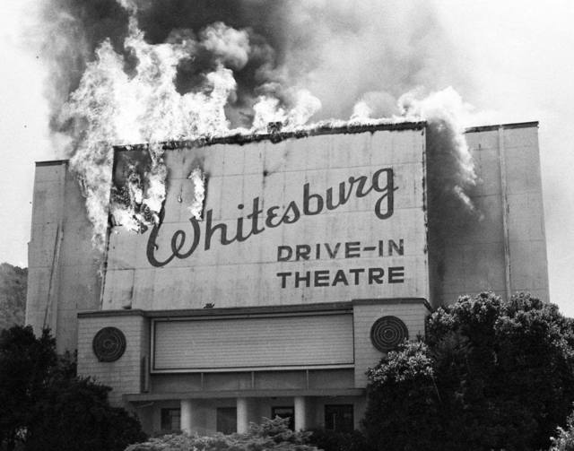
Garth Mountain is covered with neighborhoods. Think Whitesburg Drive and Drake Avenue area. Randolph High School is located on Garth. At the intersection of Whitesburg and Airport, which is the southern edge of Garth Mountain, most Huntsvillians have experienced the steep hill while crossing Whitesburg heading toward Jones Valley or going the opposite direction and having to lock up your brakes to stop at the traffic light. The Whitesburg Drive-In was also near this intersection until it was burned down in 1980.
Morris Mountain - 784 ft.
It's times like this when I wish I knew exactly where South Huntsville turned into South South Huntsville but I think it's right around Morris Mountain. Morris is the small hill sandwiched between Lily Flagg and Weatherly east of Memorial Parkway. Full of single family homes, there is almost no green space on Morris Mountain.
Weatherly (883 ft.) & Mathis Mountains (1,027 ft.)
Moving south from Morris Mountain, Weatherly and Mathis Mountains are right in the middle of south Huntsville neighborhoods. There is plenty of undeveloped land but it appears to belong to a handful of homeowners with spacious backyards.
Keel Mountain
Out 72 East in Gurley, Keel Mountain is best known for the appropriately named Keel Mountain Preserve maintained by The Nature Conservancy based near DC. The Preserve is home to the "Lost Sink" waterfall, as well as, an endangered flower which is exclusive to our local mountains. A Google search also shows a firearm and munitions company of the same name resides atop Keel Mountain.
Finally, there's the legend of lost gold buried somewhere on Keel Mountain. The story goes that a Union shipment carrying $50,000 in gold currency was ambushed by Confederate soldiers however, the valuable contents of the shipment were unknown to the attackers. At the first sign of trouble, a Union soldier moved the bags of gold to his horse and took off in a separate direction while the main forces were preoccupied. However, a single Confederate soldier chased him down and shot him. After seeing the sacks of gold and overcome with greed, the Confederate soldier simply buried the bags, intending to return after the war, and rejoined his comrades. Some months later, the soldier took a slug to the stomach in battle. On his death bed, he incoherently shared his secret but some parts of the story were not understood including the location of the buried gold.
| Back to Part Two (North Huntsville) |
Eric Adams
Eric has been an Editor for Huntsville Outdoors since 2012. His outdoor qualifications include: owning a canoe, enjoying the outdoors, and knowing how to type.
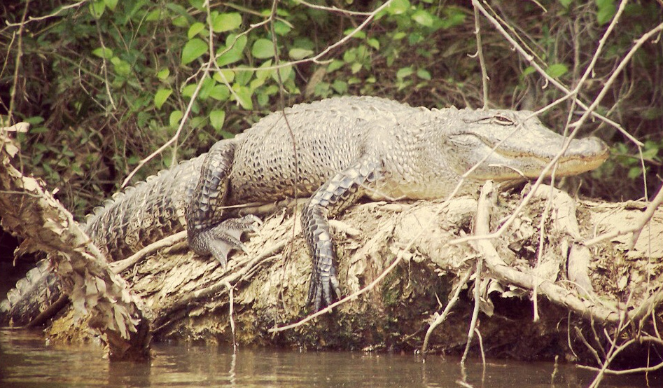
Tracking the American Alligator in Limestone Bay
So you've heard the rumor that Huntsville is home to alligators but just can't come to terms with it without seeing one with your own two eyes? Well, we've got a paddling trip for you. Head on over to Limestone Bay, just south of Mooresville, Alabama for an experience you will not soon forget.
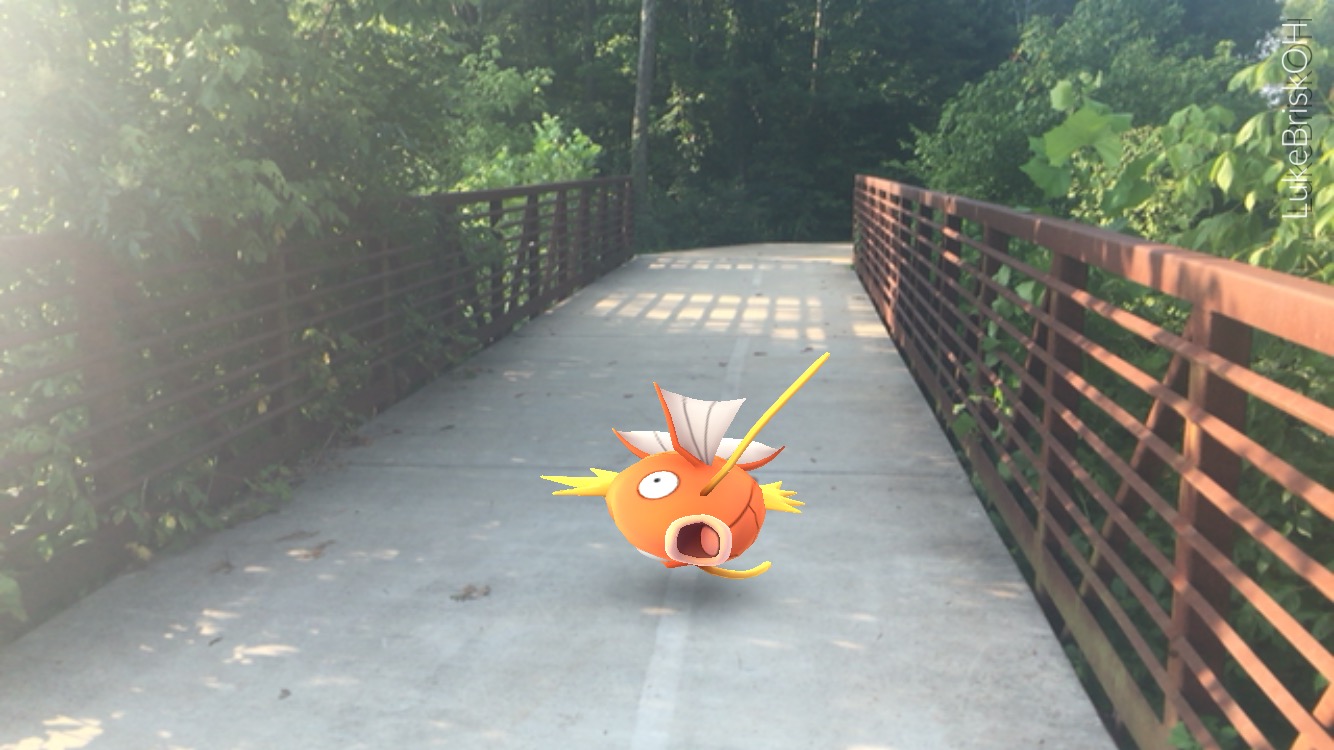
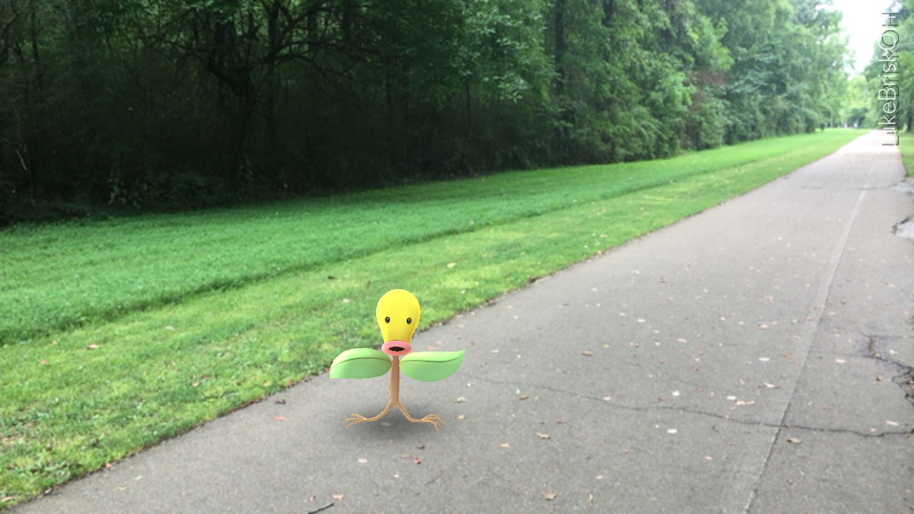
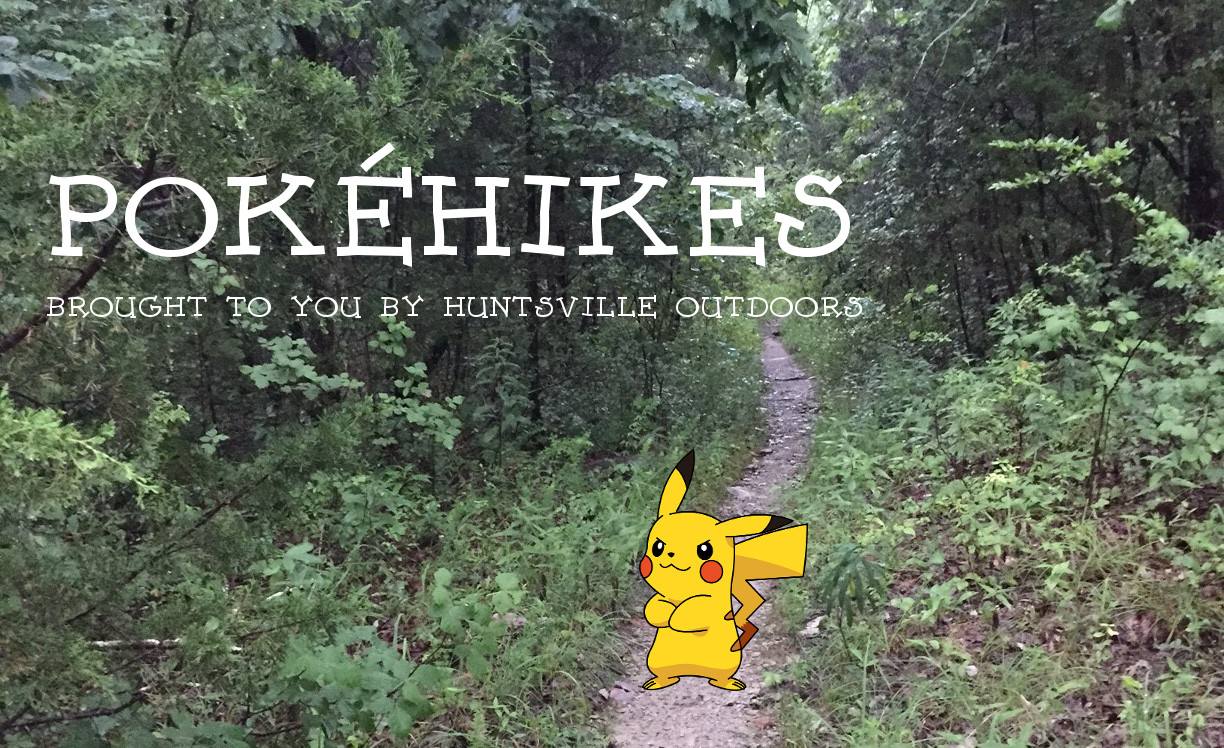
The Best Pokémon Greenways
Here at Huntsville Outdoors we have always been into greenways and over the past month we have spent way more time than grown adults should tossing Pokéballs at various Pokémons in and around Huntsville. So we took a page out of Captain Planet's book to combine their powers to increase our enjoyment of both exponentially.
Nests
Something we have learned over the past few weeks is that there are certain areas that have concentrated spawn points for specific semi-rare Pokémons. These are called nests. The Pokémons that spawn from these places will change periodically. For example the extremely popular hunting ground of Big Spring Park was a nest for Magmars at launch then changed to a nest for Electrabuzzes and will likely change every few weeks. While some of the greenways may be lacking in gyms or Pokéstops, they make up for it with nests.
Bradford Creek and Mill Creek Greenway (1 Gym, 3 Pokéstops, 1 Nest) 5.4K
Eggs Hatched 2K (2.7) 5K (1.25) 10K (0.5)
Starting at the Bradford Creek Greenway parking lot off of Palmer Road, take the Bradford Creek Greenway north to the multi-use path that parallels Mill Road and follow it to reach the Mill Creek Greenway which you will then walk it in its entirety. This route will take you directly by one gym and three Pokéstops. A quick jaunt down the Mill Creek Greenway will give you two more Pokéstops and a nest.
Indian Creek Greenway (1 Pokéstop, 1 Nest) 9.7K
Eggs Hatched 2K (4.85) 5K (1.95) 10K (0.97)
Indian Creek Greenway may only have one Pokéstop but it makes up for it by having a large nest with a majority of its spawn points between Creekwood Park and the Farrow Road Bridge. Park at either Creekwood Park or the new lot off of Old Madison Pike then take the greenway from the end to include the Creekwood Park branch and sidewalks around the playground and dog park. Be prepared! With a single Pokéstop on the route and only two others close by, you need to have a good stash of Pokésballs before you go.
Wade Mountain Greenway (1 Pokéstop) 3.2K
Eggs Hatched 2K (1.6) 5K (0.64) 10K (0.32)
Even though the Wade Mountain Greenway is the shortest walk we are featuring, its 0.93 Pokéstops per kilometer ratio is by far the highest. If 3.2 kilometers are not enough for you then where the paved greenway ends and the Wade Mountain Nature Preserve network of single track trail begins, you can easily double the amount of eggs you hatch.
Here is a map of the Wade Mountain Trails:
Aldridge Creek & Tennessee River Greenway (5 Pokéstop, 3 Gyms) 20K
Eggs Hatched 2K (10) 5K (4) 10K (2)
Taking the Aldridge Creek and Tennessee River Greenways in their entirety out and back makes this over twice as long as next longest route (Indian Creek). There are also three Pokéstops and one Gym just off the greenways located at McGucken and Southside Parks as well as Ditto Landing.
Additional Resources
If you want to know more about greenways, be sure to check out our Greenway Guide. If Greenways aren't your thing, take a look at our Pokéhikes article which has been evolved to include a fourth Pokéhike and our Monte Sano Trail Guide. A lot of the information about the locations of the nests, Pokéstops, and gyms have come from the Pokémon Go Huntsville Facebook Page and their collaborative Google Map.
Luke Brisk
Luke has been writing for Huntsville Outdoors and screwing up its source code since 2013. He is an Eagle Scout hailing from the Central Minnesota Council’s Troop 88. A majority of his time outdoors is spent either on a greenway or a trail.
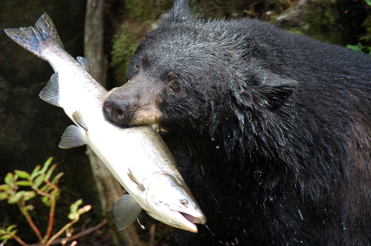
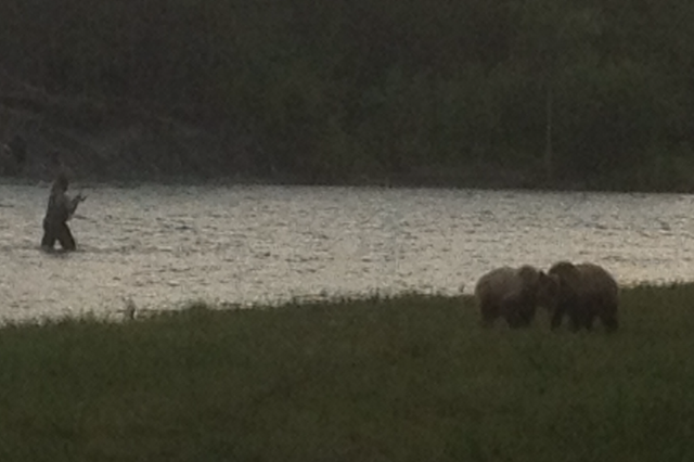
Bears Return to Northeast Alabama
Davy Canupp
We've previously written about the return of the American Alligator in Alabama, and this afternoon, we were pleased to also see confirmation that the beautiful Black Bear is making a comeback in the northern portion of our Great State. Previously, Black Bears had been extirpated from all areas of Alabama save a few small habitats in the extreme southern portion of the State.
February 2013 - Evan
The latest saga in our continuing quest to find Huntsville's great outdoorsmen (and women) recently led us to a local watering hole to meet with Evan Dial. Evan has lived in Huntsville since he was just 5 years old, and hearing him tell tale of his adventures, it sounds like he's experienced just about every bit of our regional offerings.
He's simply done it all, folks. From hiking the back trails of Monte Sano and the Powerline Trail at Blevins Gap, to Buck's Pocket and the Walls of Jericho, all the way to Big Tree in Bankhead and to Stephen's Gap east of town, this man has covered some serious ground.
Although Evan is first and foremost a hiker, he's got well-rounded credentials: he's also dabbled in rock climbing, and has done whitewater rafting in several locations (notably on the Snake River in Wyoming), and has kayaked locally on the Flint, Hiwasee, Buffalo, and a few others. Furthermore, he's trout-fished on the Tellico River in Tennessee and is an accomplished runner, having competed in two half-marathons.
But perhaps Evan's best accomplishment is persuading his girlfriend to say "YES" while in the middle of her first backpacking trip in the Smokey Mountains at Charlie's Bunyan. Here at Huntsville Outdoors, we have a hard enough time convincing our wives to accompany us on casual camping trips; we are particularly impressed that Evan not only managed to have his girlfriend hike with him, but also managed to get her to sign on for a whole life of outdoors adventures.
And speaking of a life of outdoors adventures, it's not enough for Evan to simply spend free time doing outdoors activities. He also took a second job working at Mountain High Outfitters, just for the heck of it (and the discounts, we are sure!).
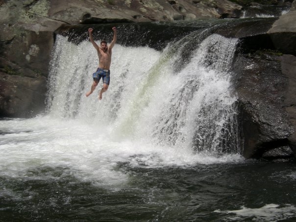
During our "interview" with Evan, we asked him to share with our readers (1) his favorite local outdoors activity and (2) his own personal outdoors goals. He was quick to answer both questions. Hands down, he says Walls of Jericho is the best hike in the Huntsville area. About 3 miles down a hill and 3 miles back up, the hike is fairly intense; but Evan says the beauty of the falls is unmatched, and there is some swimming to be had if the weather is right.
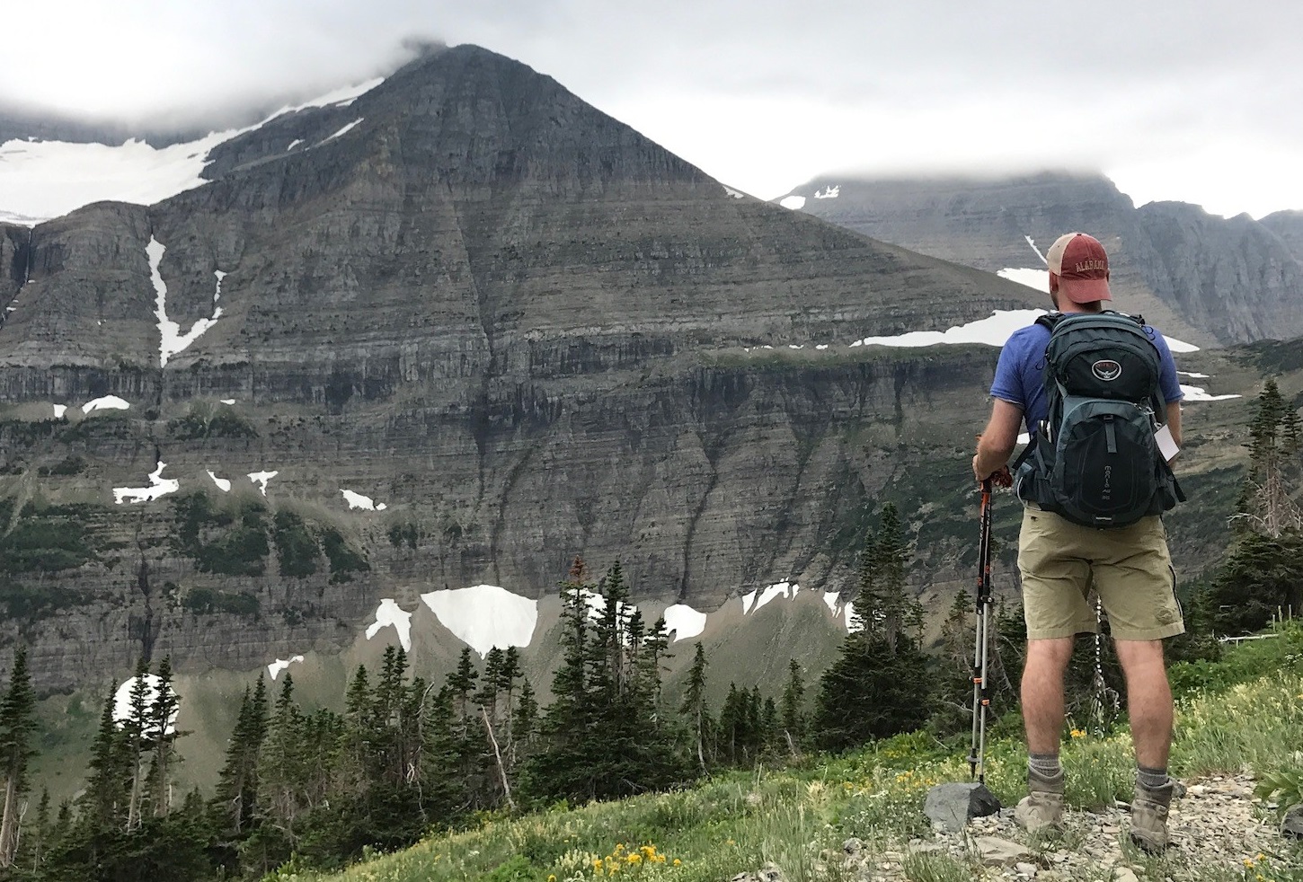
As for his own objectives, Evan tells us he'd love to hike Glacier National Park (one of your writer's goals as well) and to climb Grand Teton. Well Evan, you certainly have the resume for it, and we suspect it won't be long 'til you make it there. Perhaps a honeymoon hike is in your future???
Anyway, a big congratulations to the latest Huntsville Outdoors featured outdoorsman. Nice work, Evan.
{gallery OOTM/Evan|Photo Gallery}
Davy Canupp
Oak Park Yeti?
Huntsville Outdoors is no conspiracy website. Our mission is to catalogue outdoor adventures unique to the north Alabama area. But we can't help but report on some concerning developments in the ongoing controversy in Oak Park, the neighborhood just north of Five Points, where the Land Trust recently opened a new trail. Shortly after the trail opened last year, reports started coming in that there was something strange going on along the 1.26 miles leading up to Buzzard's Roost. A combination of unusual occurrences led some to question whether Bigfoot has made it to north Alabama.
We first heard of it second-hand from a hiker who lives in the area. We've also heard reports of unusual feces on the trail appearing somewhat like bear scat, but without the characteristic berries. There was talk of involving the Alabama Department of Conservation and Natural Resources. The State Department of Conservation tracks bear activity, and has seen an uptick in sightings across Alabama. To our knowledge, these reports of a sasquatch in our cozy corner of the State were either never made or never acted upon. Then, a few months ago, reports blew up on local Nextdoor pages that there may actually be an "Oak Park Yeti." Area residents who have catalogued the series of unusual observations obviously want answers.
Huntsville Outdoors had not been inclined to help find those answers until recently, when we encountered a local resident with a specific story.
This area resident, who wished to remain anonymous given the stigma associated with these sightings, told us that he's twice seen unusual figures in the night from his kitchen window. One night in particular a few weeks before publication of this article, he thought he saw a figure in his back yard carrying a large, 24-pack case of Natural Light canned beer. It was dark out and he did not have his rear flood lights on, but assuming that a friend had stopped by to watch a basketball game, the resident swung open his rear screen door and alighted onto his covered back patio to welcome the friend. What happened next terrified him. Out of the corner of his eye, he saw what at first looked like a person half jump, half climb over his 4 foot backyard fence, dropping the 24-pack of beer on the ground behind him. As the resident walked closer, now very concerned for his safety, he saw the fleeting image of a furry creature running -- upright -- into the night, toward the Oak Park Trailhead.
The resident told us that as soon as the creature ran out of sight, he walked over to look at the case of beer. As soon as he got close to it, he realized it wasn't a new case of beer but in fact contained just crushed cans with a few drops of beer a piece. After reflecting for a moment, he realized it was actually his own beer, which he had put out for trash pick up afternoon prior. Upon walking over to the trash can, he found that someone -- or something -- had been pillaging through the trash, gathering loose food items, and apparently beer as well. The resident concluded that he had scared the beast off.
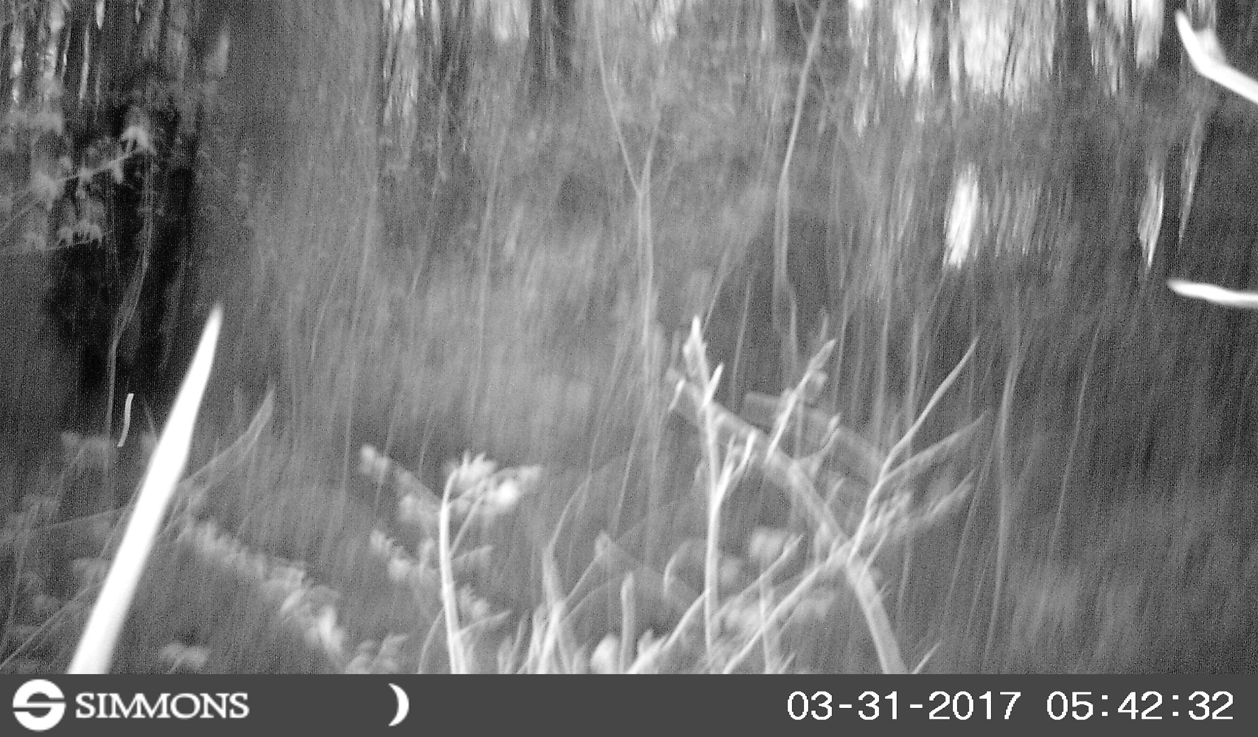
Even after the Nextdoor post, the hiker report, and this eyewitness sighting, Huntsville Outdoors was still skeptical that there was an actual Oak Park Yeti. But a few days ago, spurred by major news channels broadcasting reports of Bigfoot causing a car wreck in Idaho, we decided it was time to get to the bottom of the controversy. We approached an area resident with the idea to place a game cam along the trail and elsewhere in the neighborhood. Last night, we harvested our first batch of images. And oh man. SOMETHING is definitely going on in Oak Park.
The photographs posted below look pretty conclusive to us. Whether it's a true Bigfoot living at the base of the Mountain we can't say just yet, but there is definitely an animal in Oak Park that (1) poops on the trail; (2) rummages through garbage; and (3) apparently has a taste for cheap beer. Right now, we are looking to hear from additional residents who might help us confirm this story. We are reticent on matters such as this, but given the information and evidence we've collected, it seems like going public is the right thing to do. So let us know what you know. Help us draw some conclusions. And in the meantime, be careful out there, Oak Park. You are not alone.


Davy Canupp
Buzzard Falls Trail
This article was generously submitted by one of our readers, Stuart Obermann. With the exception of the "Buzzy" photo, all photos belong to him. Thanks, Stuart!
Buzzard Falls is a new trail on Green Mountain in South Huntsville. Green Mountain is known by many in the hiking and trail running community for its popular trails on the north end, including the Fanning and Varnadoe Trails in the Blevins Gap preserve. However, few people know much about the equally beautiful areas both above and below the bluffs at the south end of Green Mountain.
Rockhouse Cave and Lookout
Davy Canupp
This website was founded on the premise that Huntsville needs an online compendium of great makeout spots. Wait. I mean graffitied caves. Crap. What I really mean is this website focuses on cataloging those almost completely unknown outdoors spots where awesome adventures await. And Rockhouse Cave definitely fits within this category. Actually, it fits within all of these categories.
So what is Rockhouse Cave? Try searching the Internet for information. Good luck. Try asking around. Maybe a few people have heard of it, but they can’t remember where it is. We are told by Wheeler officials that the Cave was used in the filming of the movie “Tom and Huck” in 1995, but we didn’t get any more details than that, and neither of us can remember seeing that movie anyway.
We actually first heard about Rockhouse Cave from a reader of the site, who was having trouble remembering where it is located. After a little investigating, we pinpointed the location (link approximate) and also did some research about its features. OK, that’s fancy-talk for: we went and checked it out!
Rockhouse Cave is actually a series of caves (we counted 5 entrances), located on Wheeler Wildlife Refuge, just a couple hundred yards from the northern banks of the Tennessee River. You can get there by exiting I-565 at Exit 2 and heading south until you find Rockhouse Road. Rockhouse Road dead-ends into a dirt road, at which point you are very close to the cave. Below, you can see the location where Rockhouse Road turns to dirt; take a left at the sign and then look for the iron gates:


Our source warned that we should not enter the cave without a bike helmet, a flashlight, and clothes that we didn’t mind getting ruined. We doubled up on the flashlights and brought one glow stick to help mark our way out, but ignored the rest of the advice. We partially regretted that as we bumped our heads and slid around in thick cave mud.
When you first approach Rockhouse Cave, you’ll encounter an iron gate that remains closed year-round to deter those who are up to no good. Go on past that and you will find an excellent view of the Tennessee River at a spot called Rockhouse Lookout. The Lookout is basically the edge of some bluffs that tower over a stream that seems to connect to the Tennessee River. Here’s the view:
From the Lookout, you can go left or right to find cave entrances, but the “main” entrance is to the left and down a small rock passageway. It looks like this:
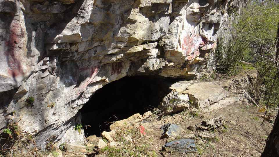
A little bit beyond the entrance to the cave is this very serious warning, which caused several in our party to give up spelunking forever:

(In all seriousness, we’ve spoken to the people at Wheeler about the all the graffitti and the trash, and they have basically asked us to help find somebody who can keep this place clean. So, if you are interested in a public interest project, let us know and we will come too).
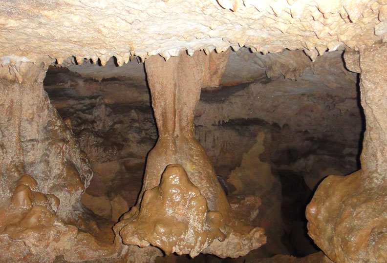
Once you get past the spraypaint, you will quickly realize that this cave is something pretty special. It’s no Cathedral Caverns or anything, but there are real stalactites, stalagmites, old panties, and yes, many real bats:
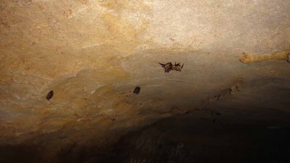
There are about 3 large rooms within the cave that have water (blind fish included), cool cave formations, cave salamanders, and numerous smaller tunnels (this is where the need for a helmet comes in). We explored a few small tunnels during our trip, but getting very far requires some serious crawling around.
Once we finished up in the main entrance, we checked out the other four potential entrances. We didn’t go in far enough to discover if these alternative entrances eventually connect with the main cave, but we suspect that if you crawl around long enough, you’ll find them all connected together. Not that we necessarily endorse this; it looks like pretty dangerous crawling. A few photos of the secondary entrances are in the photo gallery below.
In summary, if you live in or around Huntsville and appreciate the outdoors, this is definitely somewhere that should be on your list of places to visit. For one thing, Huntsville is known as a cave destination, and as a few beer aficionados may know, it was referred to as “Cave City” before it became the “Rocket City.” Knowing that, how can you live here without having visited at least one cave?
Moreover, as many commercialized caves as there are out there, it is pretty rare to encounter an underground adventure that you can explore without a tour guide who requires that you stay within limited access areas.
So, check out Rockhouse Cave. Bring a helmet. Bring a flashlight. Bring something to fight zombies. And please, bring some garbage bags.


The Making of Amendment 2
Davy Canupp
With the election upcoming, we've had readers ask how we feel about the proposed Amendment 2 to the Alabama Constitution of 1901, which proposes changing the State Constitution in two ways: first, to protect up to 50,000,000 annually of state park revenues from diversion to other state programs, and second, to permit private corporations to operate and maintain state park lands, golf courses, and accommodations. Since one of our editors (this one) is an attorney, it struck us as responsible to provide some commentary on the topic, while stopping short of taking a position on the measure.
Alabamians will see the following language on their ballot this November 8, but as you read it, keep in mind that it is only a summary of what the actual law says:
Proposing an amendment to the Constitution of Alabama of 1901, to prohibit any monies from the State Parks Fund, the Parks Revolving Fund, or any fund receiving revenues currently deposited in the State Parks Fund or the Parks Revolving Fund, and any monies currently designated pursuant to statute for the use of the state parks system from being transferred for another purpose other than the support, upkeep, and maintenance of the state parks system.
Notwithstanding, in the event that guest revenues to the State Parks Revolving Fund exceed the threshold of $50 million (as annually adjusted based on increases in the consumer price index) in a fiscal year, the sales and use and cigarette tax revenue distributed to benefit the State Parks System shall be reduced in the following fiscal year. The amount of the reduction shall correspond to the amount of guest revenue to the State Parks Revolving Fund exceeding the threshold. The amount of tax revenue not distributed to benefit the State Parks System shall be distributed to the General Fund.
Proposing an amendment to Amendment 617 of the Constitution of Alabama of 1901, to allow the Department of Conservation and Natural Resources the option to provide for the operation and management, by non-state entities, of hotels, golf courses, and restaurants at any applicable state parks in Alabama.
Much has been written about the proposed amendment, including an excellent objective summary by Ballotpedia. But none of the literature to date speaks to the actual compromises made in the process of putting together a final version, and the positions of the various players. To dig a little deeper, we examined the legislative history of the ballot measure. "Legislative history" means the actual drafts of the bills presented before the Alabama Legislature, and in this case, the legislative history reveals something very interesting. Amendment 2 as it was originally written and introduced was simple and only sought to protect state park funds. The first draft of Amendment 2 said nothing about allowing private corporations to operate or maintain state parks.
You can read the various versions of the bill here. As originally introduced, the bill was just over a paragraph long and simply stated that the Legislature was prohibited from moving monies away from state parks, as was infamously done last year. However, as the bill went through committee, it ballooned to a whopping 12 pages, and included totally new provisions. For starters, the bill introduced the concept that once state park revenues reached $50,000,000 (which seems unlikely), the state parks would see a reduction in the percentage of cigarette tax revenue that is allocated to their benefit. Second, the bill text now was modified to include a change to a previous amendment to the Constitution, Amendment 617.
Amendment 617 was passed in 1998 and provided for $100,000,000 of bonds to be let by the State for work on state parks. At the time, the bond measure had stipulated that for park projects financed with bond money, only the State could operate the parks themselves. Someone, at some point in the process of this most recent legislative measure, decided it was an opportune time to target that limitation, which the voters had approved in 1998. Amendment 2 entirely re-works Amendment 617 and basically eliminates its prohibition on private contractors operating and maintaining state park "land and facilities" that either received or is eligible to receive (it's not clear which) a portion of this bond money. It's not exactly clear from the limited available legislative history who person or entity was that spearheaded this addition, but we do know that amendments were offered twice on the bill, first by Senator Orr (R - District 3), and later by Senator Scofield (R - District 9), the latter of whom was the bill's original sponsor. Best we can tell, no legislator has come out to address whose idea this amendment was, the motivation for it, or the person or entity who requested it. No one has addressed why the private contractor piece is an improvement to the bill as it was originally conceived.
Huntsville Outdoors certainly takes no position on whether the Amendment is wise or unwise. It's not really our calling. We just write about cool makeout spots. But we feel like there are some issues that ought to be considered here that aren't addressed by those seeking our votes for or against the Amendment. For instance, it may well be logical to allow some contractors to assist with the operations of the State's parks. It was, after all, through the use of contractors that Roland Cooper State Park kept its doors open this past year during a budget shortfall. And perhaps contractors could run the parks more efficiently or bring new ideas to the table.
But if that is the case, it is fair to ask whether contractors have already brought ideas to the table, perhaps approaching legislators to seek the amendment. In other words, it would be nice to know what the Legislature has in mind for contractors to do. While private operation of certain aspects of parks may do some good, voters need to know whether the Legislature or state regulators intend to place limits on what private corporations could do, or whether the parks will literally be turned over to contractors. It's fair to ask whether private entities could change the admission fees for the park, and if so, where the excess dollars would go.
It's fair to try and get an understanding of what is meant by the term "land and facilities," as used in the Amendment. Seems to me like that means a contractor could run everything. If so, it's fair to ask the extent to which decisions of private entities would be subject to state regulatory approval. It's fair to ask whether private contractors would be allowed to perform traditional state functions, like providing security at parks. One would ideally like to know whether management of state park lands includes the right to close off areas of the parks or to clear-cut areas of land and sell the timber for profit. And it's worth asking whether private contractors would be accountable, either to the public or to regulators themselves, for decisions made in state parks -- or whether the free market will be the only limitation. The Amendment itself says nothing about these questions, and like so many things, the devil is in the details.
We want to reiterate that Huntsville Outdoors takes no position on the Amendment. But we do encourage our readers to ask questions of their legislators. We think the articles thus far do not address the actual motivations for the private contractor portion of this Amendment, and we think the voters would benefit from some additional insight.
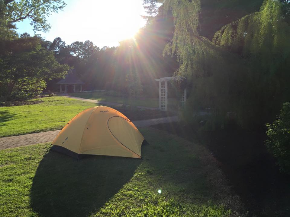
Camping with Young Children Doesn't Have to be Awful
If you have little ones and are looking to take the next step from backyard camping, we highly recommend one of the Huntsville Botanical Garden's family campout events. Simply bring a tent and sleeping bags and the Garden staff/volunteers do the rest. And because most of the work is handled by staff, parents get to actually enjoy the night. It's also perfect for single parents or parents who have little exposure to camping.
When you arrive around 5pm on Saturday, you're allowed to drive straight into the camping area near Dogwood Grove. Set up camp and then move your car out of the camping area (about 50 yards away).
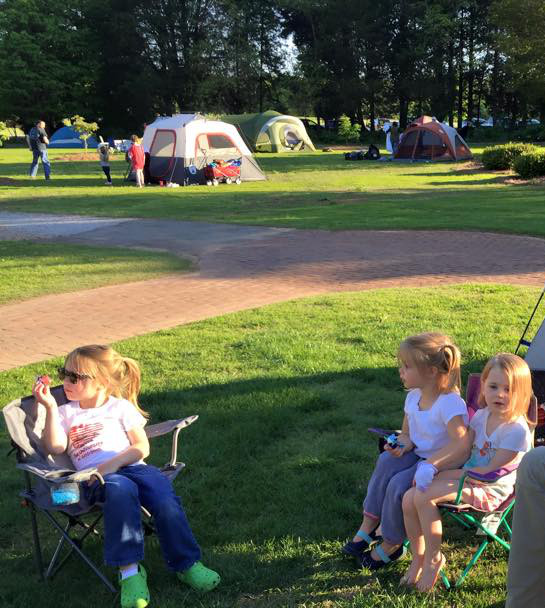
Dinner consists of hotdogs, chips, juice, etc.--standard camping fare. There are several fire pits set up and kids can cook their own hotdogs on a stick or cut to the chase by grabbing some already cooked hotdogs. Then enjoy the next 30 minutes while your kids avoid their food at the same time insisting they're not done eating until they eventually wander off having not taken a bite.
Then everyone loads up for a hayride to the outdoor Amphitheater. Depending on the weekend, it could be a movie or some wildlife exhibit. There's free popcorn and some $1 candy. Then back to camp for s'mores. Again, the staff handle all the details. Wooden sticks are provided along with marshmallows, chocolate, and graham crackers.
Lastly, the Von Braun Astronomical Society has some telescopes set up. Volunteers take turns showing the kids different objects in the night sky.
Bonus: Restrooms are a short walk from your tent.
Eric Adams
Eric has been an Editor for Huntsville Outdoors since 2012. His outdoor qualifications include: owning a canoe, enjoying the outdoors, and knowing how to type.
New Monte Sano Land Trust Map
With the recent opening of the Oak Park trail head the Land Trust of North Alabama has released a new map but the two new trails aren't the only changes.
Madison Greenways: Outside the lines
The city of Madison took a huge step toward cyclist and walker/runner equality by announcing that it will be removing the striping that restricted the two groups from intermingling on their greenways. On June 13th the City of Madison released a statement on city's website saying that "There will no longer be dedicated pathways for walkers / joggers and bike riders." They also asked that citizens "Please share the Greenway and be mindful of others."
Not only does this change in policy unite our community it will also save the city tens of dollars on paint each year which can be used to make up for the millions of the dollars that Limestone County owes to the Madison City School District.
Stop What You're Doing and Go Paddle the Sipsey
Maybe you've heard of the Sipsey River; maybe you haven't. Whichever the case, stop what you're doing and make the trip today…or at least soon. If you're even slightly familiar with the Sipsey, then you know how infrequently sufficient the water level is to allow safe navigation of this river. Additionally, the Sipsey River is as good as it gets in North Alabama. Why are you still reading? Go!
Actually, it's probably good you're still reading because we've got boat loads of tips about the Sipsey. For one, put-in and take-out locations for the most popular run. And no, John Foshee's book doesn't really help here. His book is at least 10 years out of date and it's description of the take-out is outdated…not that it's hard to find mind you. Knowing the proper water level is important too. According to multiple sources including park rangers within Bankhead, the USGS gage height should be within 4-7 feet for safe navigation.
The Sipsey River is Alabama's only "Scenic and Wild" river designated by Congress in 1988 and maintained by the U.S. Forest Service. Wild and Scenic is simply a designation made to preserve "certain selected rivers ... which ... possess outstandingly remarkable scenic, recreational, geologic, fish and wildlife, historic, and cultural ... values" --Wild & Scenic Rivers Act, 1968. For perspective, 12,598 miles of U.S. rivers have received this designation of which Alabama's Sipsey accounts for 64 of those miles...only half of one percent.
The water is a breathtaking shade of green (and cold) and there are numerous waterfalls cascading from high rock bluffs.
Trip Report
STANDARD REQUEST: As always, please pack out what you pack in and more. At some point in your life you're bound to tip and lose all your trash downstream so why not preemptively redeem yourself now :)
Put-in
Use our map to find the Sipsey Recreation Area on County Road 60 (Cranal Rd). There's a large parking lot with restrooms. You can drive from the parking lot to the put-in via a bridge or you can just walk your kayak across the bridge. Once across, the put-in is around to the left. Another option is to put-in at Thompson Creek off Forest Service Road #208. Putting in at Thompson Creek would effectively double your trip (from 9 to 18 miles).
Float
The Sipsey is a fairly easy float with one single exception--the 100 yard dash (spoken as "hundred-yard dash"). The 100-yard dash is located at about the halfway point of this trip and gets its name from the approximately 100 yards of class II rapids. Without a kayak skirt you will get wet. Just how wet is really the question. Having said that, it's a fairly harmless obstacle but don't feel bad if you tip (unless you haven't tied down your gear). Our suggestion here is to send your most experienced down first so they can retrieve any lost boats. And by "retrieve" I really mean chase your boat until the river calms and they can coral it to shore. Once a kayak has tipped and gets even a little water in it it's almost impossible to control.
In one particular trip down the Sipsey, someone in our party "exited" their kayak which then turned over and filled with water. I chased it down and grabbed hold of it. It didn't take me long to realize there was very little I could do with one free hand while holding on to a few hundred pounds of dead weight with the other. Davy and I took turns corralling it to shore while our unfortunate friend floated down to catch up with us. That brings up another tip: wear your life jacket for the 100-yard dash. And bring a change of dry clothes. The only months the Sipsey is navigable are the winter months so you'll get cold quickly once wet.
While we've yet to experience an overnight on the Sipsey, there are tons of options for camp sites. I've marked one particular ideal camp site on the map for a future trip.


Take-out
The whole trip took about 6 hours including a couple generous breaks to explore. Just a little past the Hwy 33 bridge, the take-out has a concrete or rock slide-like structure that leads up to a small gravel parking area. The path from the water to the parking area is long, steep, and difficult to get a car down.
Obstructions
Updated January 23, 2013
The first obstacle--a downed tree--at first appeared to require a portage but mad props (are we still saying that?) to Kevin who cleared a small path to the far right. If the water level had been any higher than 5.4' that day, we may not have been able to pass under the tree.
The second obstacle was another tree down but there were several feet of the tree that were mostly submerged. We recommend getting up some speed and just powering over it. If the water level had been any lower, it would have been necessary to portage.
Lastly, there was a log partially blocking the entrance to the 100-yard dash about face-level. We tried in vain to reach the log to move it but could not find a safe way. In the end, we went to the right of it. There's plenty of room.
Tips
When I went down the Sipsey last year, it was my first time so I brought *everything*. This time I wasn't so worried and forgot to bring some essentials. Luckily I didn't need any of them but several in our party did.
- You will need a change of clothes in a dry bag (secured inside your kayak). You need an extra set of EVERYTHING. That includes shoes, socks, gloves, and a hat. If you tip your kayak at the 100-yard dash you'll have to paddle about 90 minutes to the end in what is usually the colder part of the trip.
- If you want to be extra safe, pack two sets of everything just in case you have mishap unrelated to the 100-yard dash.
- I also recommend putting on waterproof pants before you hit the dash. Even if you don't tip, you will likely get soaked unless you have a spray skirt. The water is a chilly 45 degrees in January. Not exactly hypothermia-cold but certainly unpleasant especially once the sun goes behind the trees.
Eric Adams
Eric has been an Editor for Huntsville Outdoors since 2012. His outdoor qualifications include: owning a canoe, enjoying the outdoors, and knowing how to type.
Monte Sano Pokéhikes
If you have left your house recently there is a good chance that you have seen people of all ages glued to their phones playing Pokémon Go. If by the off chance you have not noticed this phenomenon you are either unaware of your surroundings or you yourself are playing this addictive game. If standing around Big Spring Park isn't your thing here are four Pokémon Go hikes you should check out.
*7/20/2016 Added Eevee Hike
Pidgey Hike (2 Miles)
Gyms: 3, Pokéstops: 10
The Pidgey Hike is simply the North Plateau Loop in its entirety and is great for kids.
Rattata Hike (3.5 Miles)
Gyms: 4, Pokéstops: 7
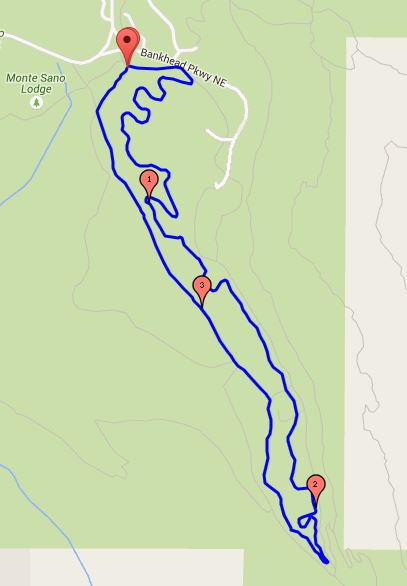
This hike's CP (that's Combat Power for the uninitiated) is a bit higher than the Pidgey Hike even though the trails themselves have the same dificulty it involves more turns. Starting from the hikers parking lot off of Nolen Drive head east on South Plateau Loop and hop on the Bucca Family Trail which you will stay on, aside from a jaunt down Bog Trail for a gym, until you reach the Fire Tower Trail. You'll stay on Fire Tower till you reach the 2nd intersection with the South Plateau where you will take a right and head northeast till you reach your origin point.
Pikachu Hike (3.5 Miles)
Gyms: 3, Pokéstops: 9
This point to point hike takes you on some of the more challenging trails in the park. You can start at the Cold Spring parking area but the mountain bikers lot off of Nolen Drive in Monte Sano State Park is better since there are more available spots. Start by heading down Sinks Trail going past Three Benches until you reach Stone Cuts. Make your way through all of "cuts" until the intersection with Logan Point Trail and hike it to its end where you stay straight on Sinks till you reach the Mountain Mist Trail. Take a right on Mountain Mist and stay on it till it terminates at the Cold Spring trail where you will take another right and head east till you reach the Cold Spring parking area.
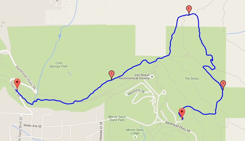
Eevee Hike (4 miles)
Gyms: 2, Pokéstops: 11
I would be remiss if we didn't add a Pokéhike on Land Trust property. Unlike the state park hikes that have Pokéstops at consistent intervals, you'll find a majority of these at the trail head. But with with 11 total, it has by far the most Pokéstops. From the Land Trust parking lot on of Bankhead Parkway you will head north on Toll Gate Trail until you reach High Trail. Take a right on High Trail, which you will hike in its entirety. The one Pokéstop on High Trail is at the Hotel Basin Trail, which if you take the time to explore leads to some ruins of the Monte Sano Hotel that was built in the late 1800s. Back to the trail!
When High Trail ends take a hard right on to Bluff Line Trail and head east. Soon you will reach a section where the Bluff Line and Wagon Trail merge. If you're looking for a Gym, head a short distance down Wagon Trail then come back to the merge when you're done. Continue through the merge where you will take another quick jaunt back down Wagon Trail and hit a Pokéstop before returning to Bluff Line where you stay unil you get back to the Land Trust parking lot.
If you find any Pokémons while hiking take a picture and share it with us; we will post the best ones on our Facebook page.
Luke Brisk
Luke has been writing for Huntsville Outdoors and screwing up its source code since 2013. He is an Eagle Scout hailing from the Central Minnesota Council’s Troop 88. A majority of his time outdoors is spent either on a greenway or a trail.
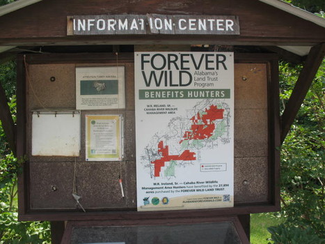
Forever Wild Renewal
Davy Canupp
This year's election may be very divisive at the federal level, but when you go to the polls next month, there is one item on the Alabama ticket that ought to be a no-brainer: Amendment 1, which re-authorizes the Forever Wild Program.
Privacy Policy
Huntsville Outdoors does not share personal information with third parties nor do we store any information about your visit to this blog other than to analyze and optimize your content and reading experience through the use of cookies.
You can turn off the use of cookies at anytime by changing your specific browser settings.
We are not responsible for republished content from this blog on other websites or publications without our permission.
This privacy policy is subject to change without notice and was last updated on July 19, 2016. If you have any questions feel free to contact us here.
Google Ads
Third party vendors, including Google, use cookies to serve ads based on a user's prior visits to this website or other websites.
Google's use of advertising cookies enables it and its partners to serve ads to you based on your visit to this sites and/or other sites on the Internet.
You may opt out of personalized advertising by visiting Ads Settings.
You may also visit those third-party websites to opt out of the use of cookies for personalized advertising (if the vendor or ad network offers this capability). Alternatively, you can opt out of some third-party vendors’ uses of cookies for personalized advertising by visiting www.aboutads.info.
September 2012 - Del
As a part of Huntsville Outdoors' commitment to promoting interest in -- well, the outdoors -- we are proud to announce our first inaugural "Outdoorsman of the Month"! This is an exciting moment for us. It marks the culmination of an exhaustive search that took us as far as a small watering hole on County Line Road, where we met a FedEx driver, and our new friend, Del.
Del, you should know, is not just an ordinary FedEx driver, but a real renaissance outdoorsman -- a guy who's served in the Armed Forces, canoed a bunch of rivers, drank a bunch of Guinness, lived in Alaska, and survived a face-to-face with a Grizzly Bear. What better candidate for the first Outdoorsman of the Month?
Here's a brief rundown of Del's outdoors credentials. A self-described "fisherman first" who says he learned to paddle just so he could catch those hard-to-reach trout that like the fast-moving streams, the man now owns 4 canoes (2 solos and 2 tandems) and 1 kayak. He's a member of the Huntsville Canoe Club, and has paddled not just local waters such as the Tennessee, but the Hiwassee and French Broad in North Carolina, the Gulf of Mexico, the Little Susitna in Alaska, and the Kenai in Alaska, just to name a few.
His fishing exploits nearly caused his demise on a recent trip to Alaska, where he found himself virtually surrounded by a hungry family of Grizzly Bears (pictured above) just as he was reeling in a nice, tasty Salmon. Del says he survived the encounter without reaching for the Glock that was strapped to his chest, and even made it home with some fish. We aren't exactly sure how, but we've got mad respect for his achievement.
Speaking of Alaska, Del's the kind of guy who couldn't just be satisfied with the occasional fishing trip to America's last great Western Frontier, so he bought a cabin up there. And it wasn't good enough to simply purchase an existing home: he actually met a guy in Talkeetna and had him build a hunting outpost for Del to reside in. The place is beautiful, nestled as it is on the edge of a picturesque Alaskan lake, and perfectly suited to satisfy the whims of the consummate outdoorsman.
Unfortunately, the place turned out to be so nice that another Man of the Wild made Del an offer he couldn't refuse, and he ended up selling the place. He tells us his current goal is to find him a new cabin in central Alaska, and implement a retirement plan whereby he spends his summers in the shadow of Denali and winters on the tranquil waters of the Gulf of Mexico. Amen to that, Brother. And congratulations on becoming the first Huntsville Outdoors "Outdoorsman of the Month!"
An Open Invitation
Think you've got what it takes to qualify as Outdoorsman of the Month? Or know someone who does? Send us the info -- we'd love to hear about quality candidates. And the moniker aside, keep in mind the "Outdoorsman" by no means needs to be a "man." In fact, we'd be especially interested to hear about the ladies out there who enjoy the outdoors lifestyle.
Green Mountain Log Trail
As part of my reseach for the Spacewalk Scout trail, I wanted to run as many of the trails along the route as I could. Having not spent alot of time up on Green Mountain, the Green Mountain Log Trail was one that intrigured me.
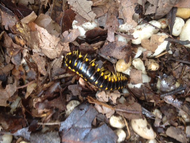
Millipede!
This weekend I took my daughter up to Rainbow Mountain for her to get rid of some extra energy at the playground and take some pictures for an upcoming article I am writing when out of the corner of my eye I saw one of the craziest insects I have ever seen.
Bog Trail
Not every trail is glorious but every trail serves a purpose. While short the Bog Trail should not be dismissed.

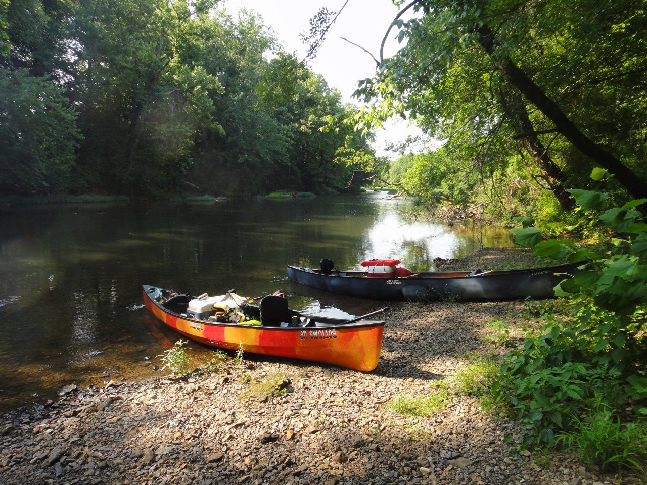
Flint River Canoe/Camping
I've always maintained that canoeing with your significant other is a great way to see how well you work together in tense situations. If you're still talking to each other after a couple hours on the river, you're probably compatible and can go ahead and schedule that second date. Speaking of second dates, why not plan a canoe/camping trip?
Greenways: Big Picture

Fagan Creek Veiw from the VBC
For those of you not familiar with the Big Picture initiative it is Huntsville’s attempt to reach out to its residents and understand what is important them. Their website says it better than I could ever hope summarize, and believe me I tried: “Our Plan – Formulating a transparent, breathable plan with the ability to guide funding and policy decisions. This plan will be continuously updated each year to best reflect changing conditions.”
Hot Summer Nights @ Hambrick Bat Cave
Davy Canupp
So, you've read our makeout spots article and noticed we only listed 9 spots. Of course, you are thinking what the crap, Huntsville Outdoors, where is the 10th??? Calm down, we saved the best for last. If you ever wanted to make out on the water -- which we don't exactly recommend -- there is absolutely no where like Hambrick Bat Cave. Not only will you get one of the best sunset views in the great State of Alabama, but your girlfriend will be sure to literally jump in your boat when she sees 60,000 gray bats headed straight for her head. And if she's too scared of kayaks to paddle over to the cave, hop in a motor boat, because this cave is on the big water, my friends.
Madison County Nature Trail
Tired of reading all the latest horrifying world events? There’s a place in Huntsville that will take you back in time when life was simpler (let’s face it—we mean before the Internet). The 72-acre Madison County Nature Trail, located on Green Mountain, offers a glimpse of pioneer life minus all the hard work, death, and disease of course. The 1.5 mile nature trail around beautiful Sky Lake goes through a picturesque covered bridge and passes near an authentic log cabin representative of homes popular in early Huntsville.
Terms of Use
Agreement Between You and Huntsville Outdoors
The Web site is owned and operated by HUNTSVILLE OUTDOORS, LLC and is offered to you conditioned on your acceptance without modification of the terms, conditions, disclaimers, and notices contained herein. Use of the content, services, and/or products presented in any and all areas of this site constitutes your agreement that you will not use the Web site for any unlawful purpose and that you will abide by the following terms and conditions and those posted in specific areas of the site. This agreement between you and HUNTSVILLE OUTDOORS, LLC is effective until terminated by HUNTSVILLE OUTDOORS, LLC, and may be terminated or changed by HUNTSVILLE OUTDOORS, LLC at any time without notice.
Your Obligations
In connection with your use of the Web site, you shall abide by all applicable federal, state or local laws including those pertaining to such areas as libel, slander, defamation, trade libel, product disparagement, harassment, invasion of privacy, tort, obscenity, indecency, and copyright or trademark infringement. You are responsible for the content of any information that you put on the Web site. You agree that no materials of any kind submitted to the Web site by you will violate or infringe upon the rights of any third party, including copyright, trademark, privacy or other personal or proprietary rights; or contain libelous, defamatory or otherwise unlawful material or be harmful to minors in any way. HUNTSVILLE OUTDOORS, LLC has no obligation to, and does not in the normal course, monitor or control any information that is or becomes available on the HUNTSVILLE OUTDOORS, LLC Web site. HUNTSVILLE OUTDOORS, LLC reserves the right to refuse to post or to remove any information that is, in HUNTSVILLE OUTDOORS, LLC'S sole discretion, unacceptable, undesirable or in violation of these rules. However, HUNTSVILLE OUTDOORS, LLC has no obligation to exercise such reservation of rights by HUNTSVILLE OUTDOORS, LLC. By posting content to any part of the Web site, or providing content to the site owners to post, you automatically grant, and you represent and warrant that you have the right to grant, to HUNTSVILLE OUTDOORS, LLC an irrevocable, perpetual, non-exclusive, transferable, fully paid, royalty-free, worldwide license (with the right to sublicense) to use, copy, perform, display, reformat, translate, excerpt (in whole or in part) and distribute such information and content and to prepare derivative works of, or incorporate into other works, such information and content, and to grant and authorize sublicenses of the foregoing. HUNTSVILLE OUTDOORS, LLC authorizes you to view and download the materials on the Web site solely for your personal, non-commercial use. You may not sell or modify any information on the Web site or reproduce, display, publicly perform, distribute or otherwise use the materials in any way for any public or commercial purpose without the advance written permission of HUNTSVILLE OUTDOORS, LLC.
Huntsville Outdoors Copyright/Disclaimer Statement
All text, images, marks, logos and information contained on official HUNTSVILLE OUTDOORS, LLC Web sites -- including the HUNTSVILLE OUTDOORS logo at the top left of the site -- are the intellectual property of HUNTSVILLE OUTDOORS, LLC unless otherwise registered, and are protected under the U.S. Copyright Act 17 U.S.C. §§ 101-810, trade mark law, and other laws. Copyright gives the owner exclusive right to reproduce, distribute, perform, display, or license a given work. Whether or not a Web site includes a statement about copyright, the US copyright act provides protection for such works, and they may not be used or reproduced without permission. It is the responsibility of all parties storing materials on Web sites with HUNTSVILLE OUTDOORS, LLC domain addresses to ensure that such material does not violate other parties' proprietary rights and does not otherwise violate law or applicable HUNTSVILLE OUTDOOR, LLC policy. HUNTSVILLE OUTDOORS, LLC reserves the right to delete or make inaccessible files that contain material that is in violation of law or of applicable HUNTSVILLE OUTDOORS, LLC policy. HUNTSVILLE OUTDOORS, LLC is not responsible for any errors in the material provided on the Web and shall not be liable for any damages of any kind arising from the use of any material found on official HUNTSVILLE OUTDOORS, LLC Web sites or on any other sites with HUNTSVILLE OUTDOORS domain addresses.
The design, pictures, and logos used on Web sites directly managed by the HUNTSVILLE OUTDOORS, LLC Webmaster may not be copied and used or posted by any other person or entity. Links may be directed to these pages, but images, logos, maps, marks, etc., may not be copied and/or posted for any reason.
Use of the Web Site Information at Your Own Risk
The Web site may contain information or materials from various information sources including, without limitation, government agencies, other Web sites, the heads of the authors, and users of this site. HUNTSVILLE OUTDOORS, LLC does not represent or endorse the accuracy or reliability of any information or materials provided by these sources or any information, data, or analysis derived from these sources. HUNTSVILLE OUTDOORS, LLC does not represent that any information on the Web site may be downloaded outside of the United States. Reliance upon any such information or material shall also be exclusively AT YOUR OWN RISK. Neither HUNTSVILLE OUTDOORS, LLC nor its authors, contributors, founders, or agents shall be liable to you or anyone else for any inaccuracy, error, omission, poor or negligent advise, suggestion, interruption, timeliness, completeness, deletion, defect, failure of performance, computer virus, communication line failure, alteration of, or use of any content herein, regardless of cause, or for any damages resulting therefrom.
This Web site may occasionally include information describing various put-in and take-out locations for recreational or whitewater boating, and may describe places in which such boating may take place. The Web site may occasionally reflect the opinions of the authors regarding water activities and boating activities. Additionally, this Web site provides information about outdoors activities, places to visit, methods of access, etc., and opinions regarding all of these topics. All of these opinions and this information is provided AS-IS with NO WARRANTY that the information is reliable or accurate. Users should understand that ALL outdoor activity, and specifically boating and water activities, are INHERENTLY DANGEROUS and should not be attempted by novices who are not skilled in the activities to be performed. No person should ever operate a canoe, kayak or other boat without proper personal protection devices, to include a Coast Guard Approved Personal Floatation Device, Helmet, and other appropriate gear. HUNTSVILLE OUTDOORS, LLC does not recommend particular types of safety equipment but encourages all users to take appropriate steps to education themselves as to such equipment before entering any water. Users of this Web site agree that HUNTSVILLE OUTDOORS, LLC and its authors and operators shall have NO LIABILITY for any action taken in reliance upon information found on this site. Users acknowledge that outdoor and water activities carry a risk of personal injury, including potential death and loss of limb, and other serious injuries. Users expressly agree to hold harmless and indemnify HUNTSVILLE OUTDOORS, LLC, its authors, owners, operators, and founders, of any liability resulting from any activity they undertake in reliance upon information set out on this Web site.
Respect for Copyrights Including Digital Materials and Software
It is the policy of HUNTSVILLE OUTDOORS, LLC to respect the copyright protections given by federal law to owners of intellectual property, including digital materials and software. It is against HUNTSVILLE OUTDOORS, LLC’s policy for anyone to use HUNTSVILLE OUTDOORS to access, use, copy or otherwise reproduce, or make available to others any copyright-protected materials, including digital materials and software, except as permitted under copyright law (especially with respect to "fair use") or specific license. HUNTSVILLE OUTDOORS, LLC regards violation of this policy as a serious matter.
Pursuant to 37 CFR § 201.38, HUNTSVILLE OUTDOORS, LLC has designated the following person to receive notification from copyright owners of claimed infringement of digital materials and software copyright: Eric Adams and David Canupp. Those individuals can be contacted here.
Limitation on Liability
Under no circumstances shall HUNTSVILLE OUTDOORS, LLC nor its authors, members, contributors, founders, or agents be held liable for any damages, whether direct, incidental, indirect, special, or consequential damages, including, without limitation, personal injury, lost use, data, revenues, time, money, profits or goodwill arising from or in connection with the use, reliance on, or performance of the information on the Web site, even when HUNTSVILLE OUTDOORS, LLC has been advised of the possibility of such damages. HUNTSVILLE OUTDOORS, LLC shall not be liable for damages or injury caused in whole or in part, whether foreseeable or unforeseeable, and whether based in tort (including defamation), contract, strict liability or otherwise in producing and publishing this Web site or any information contained in this site or linked by or to this site. If you are dissatisfied with any of the Web site's material or services, or with any of the Web site's terms and conditions, your sole and exclusive remedy is to discontinue using the Web site.
Indemnity
As a condition of use of the Web site, you agree to indemnify HUNTSVILLE OUTDOORS, LLC and its members, authors, contributors, founders, and agents from and against any and all liabilities, expenses (including attorneys' fees) and damages arising out of any and all claims resulting from your use of the Web site and the materials (including software) thereon, including without limitation any claims alleging facts that if true would constitute a breach by you of these Terms of Use. This indemnity shall include, without limitation, any claim of inaccuracy or defamation based on materials that you submit for use on the site.
Third-Party Sites
The Web site may contain links to third-party Web sites. HUNTSVILLE OUTDOORS, LLC provides these links solely to assist users in locating other Internet resources that may be of interest to them and you assume sole responsibility and risk for your use of links to third-party Web sites. HUNTSVILLE OUTDOORS, LLC does not operate or control in any respect any information, content, products or services on such third-party Web sites. HUNTSVILLE OUTDOORS, LLC does not represent or endorse the accuracy or reliability of any of the information, content or advertisements contained on, distributed through, or linked, downloaded or accessed from any of the services contained on these third-party Web sites. No reference or link to a third party or a third-party site shall constitute an endorsement of such third party or such third-party site.
Specific Disclaimer of Warranties
ALL MATERIALS AND SERVICES IN THIS WEB SITE, INCLUDING THOSE PROVIDED BY LINKS TO THIRD-PARTY WEB SITES ARE PROVIDED "AS IS" WITHOUT WARRANTY OF ANY KIND. THE CONTENT PUBLISHED ON THIS WEB SITE MAY INCLUDE INACCURACIES OR TYPOGRAPHICAL ERRORS. CHANGES ARE PERIODICALLY MADE TO THE INFORMATION HEREIN. HUNTSVILLE OUTDOORS MAKES NO REPRESENTATIONS AND, TO THE FULLEST EXTENT ALLOWED BY LAW, DISCLAIMS ALL WARRANTIES, EXPRESS OR IMPLIED, INCLUDING, BUT NOT LIMITED TO WARRANTIES OF NON-INFRINGEMENT, MERCHANTABILITY AND FITNESS FOR A PARTICULAR PURPOSE REGARDING THE SUITABILITY OF THE INFORMATION; THE ACCURACY, RELIABILITY, COMPLETENESS OR TIMELINESS OF THE CONTENT, SERVICES, PRODUCTS, TEXT, GRAPHICS, LINKS, OR OTHER ITEMS CONTAINED WITHIN THE WEB SITE, OR THE RESULTS OBTAINED FROM ACCESSING AND USING THIS SITE AND/OR THE CONTENT CONTAINED HEREIN. HUNTSVILLE OUTDOORS DOES NOT WARRANT THAT THE FUNCTIONS CONTAINED IN THE MATERIALS WILL BE UNINTERRUPTED OR ERROR-FREE, THAT DEFECTS WILL BE CORRECTED, OR THAT THIS SITE, INCLUDING THE SERVER THAT MAKES IT AVAILABLE, ARE FREE OF VIRUSES OR OTHER HARMFUL COMPONENTS. IN ADDITION, HUNTSVILLE OUTDOORS SHALL NOT BE LIABLE TO YOU OR ANYONE ELSE FOR ANY LOSS OR INJURY CAUSED IN WHOLE OR PART BY CONTINGENCIES BEYOND ITS CONTROL IN PROCURING, COMPILING, INTERPRETING, REPORTING OR DELIVERING THE SERVICE AND INFORMATION THROUGH THE WEB SITE AND YOU ASSUME THE ENTIRE COST OF ALL NECESSARY MAINTENANCE, REPAIR OR CORRECTION ARISING FROM ANY SUCH LOSS OR INJURY.
Modification
HUNTSVILLE OUTDOORS, LLC shall have the right, at its sole discretion, to make improvements and/or changes in any aspect of the Web site at any time and does not accept any responsibility for the effects these alterations may have. HUNTSVILLE OUTDOORS, LLC also reserves the right to change, modify, add or remove terms of this agreement at any time without notice. You agree to review this Agreement periodically since such changes, modifications, additions or deletions shall be effective immediately upon posting and your subsequent use after such posting shall conclusively be deemed to be acceptance by you of such changes, modifications or deletions.
Miscellaneous
This Agreement shall be deemed to include all other notices, policies, disclaimers, and other terms contained in this Web site; provided, however, that in the event of a conflict between such other terms and the terms of this Agreement, the terms of this Agreement shall control. This Agreement has been made in and shall be construed and enforced in accordance with Alabama law. Any action to enforce this agreement shall be brought in the federal or state courts located in Huntsville, Alabama. If any provision is deemed to be unlawful or unenforceable, that shall not affect the validity and enforceability of the remaining provisions.
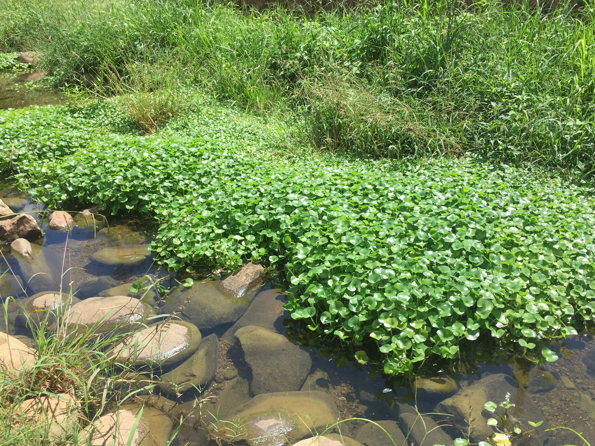
Popeye Should've Carried a Can of Watercress
If you've lived in Huntsville for any amount of time, you may have heard the term watercress. Watercress is simply a leafy plant that grows along slow-moving bodies of water and is commonly harvested for use in salads.
You may have even seen watercress while paddling the Flint River before without realizing. That's because watercress grows abundantly along many of Huntsville's local streams. It's no surprise that Huntsville was once known as the "watercress capital of the world". OK, maybe a little surprising. Let's go with mildly intriguing. That is until 1958 when Huntsville became better known as the "Rocket City" after the Explorer I satellite was launched at Redstone1. That's a net gain as far as city monikers go.
Health Benefits
Watercress contains over 15 vitamins and minerals--more iron than spinach, more calcium than milk, more folate than bananas, and more vitamin C than oranges2. Say that again?? Research indicates that the health benefits of regular consumption of watercress include reducing the risk of some cancers, as well as, reducing damage to blood cells.
You may recall an upscale restaurant downtown named after the plant. The restaurant eventually relocated to Bridge Street in the old Dolce location before closing after only a few months which is unfortunate because their bread pudding put Tim's and Po Boy Factory to shame.
Eric Adams
Eric has been an Editor for Huntsville Outdoors since 2012. His outdoor qualifications include: owning a canoe, enjoying the outdoors, and knowing how to type.
Rainbow Mountain: A Hipster Monte Sano
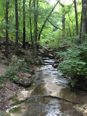
No matter what Madison does it will always be over shadowed by Huntsville which literally surrounds it as if to swallow it whole. Everything in Huntsville is bigger and some would argue better with three notable exceptions; hot wings, BBQ, and a far superior school system. (The prior statement is the opinion of the writer of this article and not the views of Huntsville Outdoors.com. But if the web server starts to generate opinions the machines have become self-aware and we all should be worried).
Big Cross and Rock Bluff Trail
We've written about Big Tree, Big Red's Chicken & Waffles (RIP), and now we give you "Big Cross". OK, it's not really called that; in fact, I think it's typically just referred to as Burritt Cross. On Monte Sano just below Burritt on the Mountain along the Rock Bluff Trail, you'll find a massive 74ft, 38-ton cement cross that surprisingly few know about and even fewer have seen. The cross was raised by the Huntsville Ministerial Association in 1963 to replace a smaller wooden cross that had been around since ~1900.
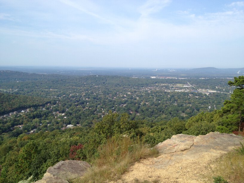
Blevins Gap Nature Preserve
For the longest time, I thought the gravel parking lot on Cecil Ashburn between Huntsville Mountain and Green Mountain was just a scenic lookout or a terribly obvious makeout spot. That is until I realized it was the trailhead to the Bill and Marion Certain Trail which is part of the 971-acre Blevins Gap Nature Preserve and leads to an amazing view atop Green Mountain.
Mountain Mist Trail
The Mountain Mist Trail is one of the more iconic trails within Monte Sano State Park and has a 50K ultra marathon named after it.
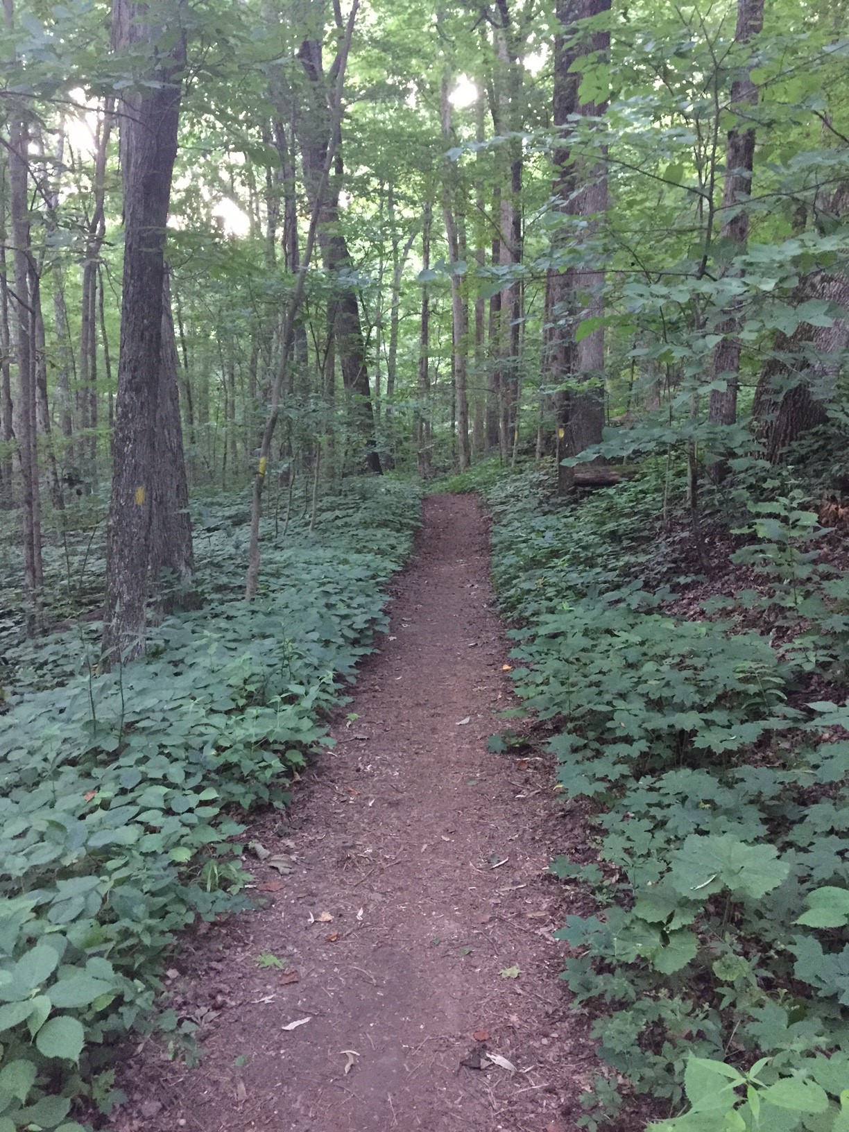
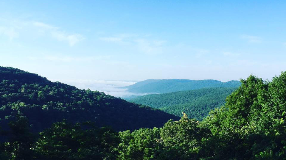
Mountains of Madison County Part One
While some may consider our "mountains" to be nothing more than big hills, most definitions do qualify Huntsville's mountains for that prestigious designation. If you've ever wanted to know way too much about our mountains then keep reading.
Sure, everyone knows about Monte Sano Mountain and probably even Huntsville, Green, Chapman, and Rainbow Mountains. But surprisingly there are more than 20 mountains within the Huntsville/Madison area. The farther northeast you travel outside of Huntsville the larger the mountains get. That's because we're in the foothills of the Appalachian Mountains. In this article, we break down the mountains by area and try to give a little information on each.
We're going to start with Madison city and Redstone Arsenal. North Huntsville and downtown Huntsville will follow.
Redstone Arsenal
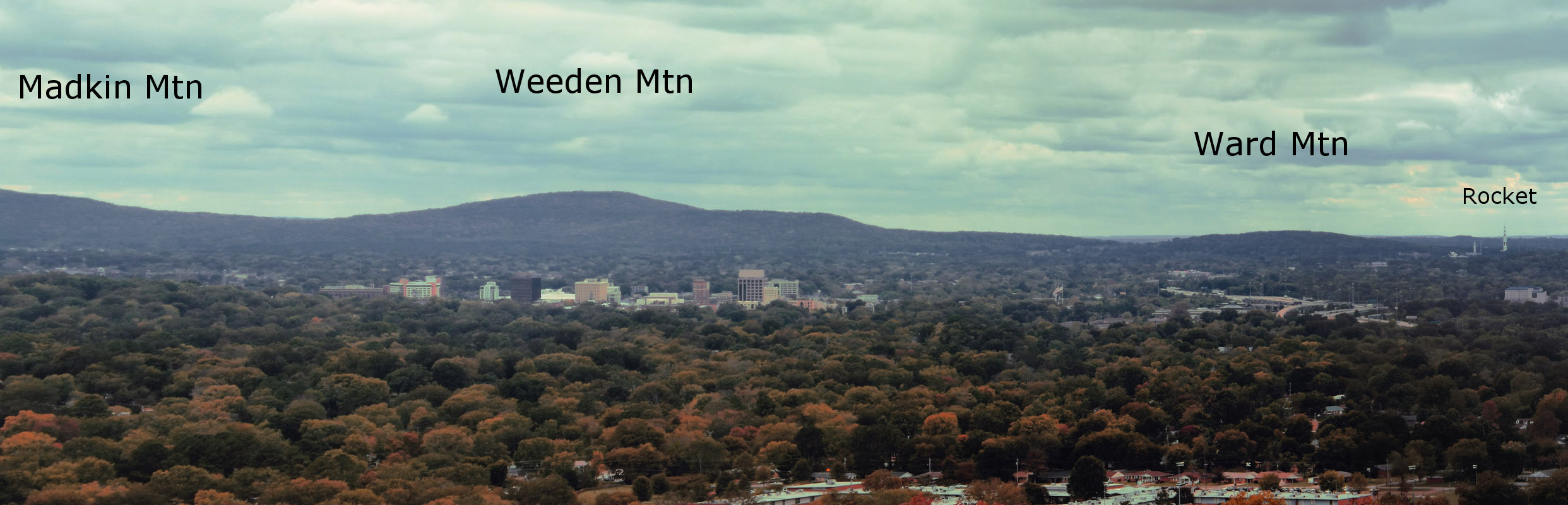
Ward Mountain - 902 ft
Ward Mountain is just south of the US Space & Rocket Center. On the mountain itself, there's an old radio site and a cemetery. At the base is the Army Health Center. On the map below, Ward is the northern most end.
Weeden Mountain - 1,217 ft
The inspiration for the on-post restaurant by the same name, Weeden Mountain itself is most likely named after Huntsville poet, Maria Howard Weeden. Weeden Mountain is just south of Ward Mountain and north of Madkin Mountain.
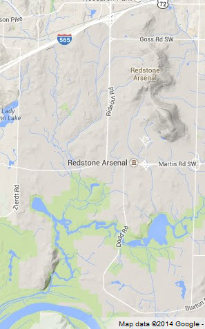
Madkin Mountain - 1,233 ft
The highest point on Redstone Arsenal, Madkin Mountain is home to a short running trail and a Verizon cell tower. It's also where the infamous 1989 F4 tornado initially touched down before continuing on to the Airport/Whitesburg area.
Bradford (679 ft) & Hatton (816 ft) Mountains
Not a lot of known history about these mountains. They don't actually qualify as mountains due to their heights. Located near Gate 7 (interseciton of Martin and Zierdt Road), there is a historic cemetery in the valley created by the two "mountains".
Madison
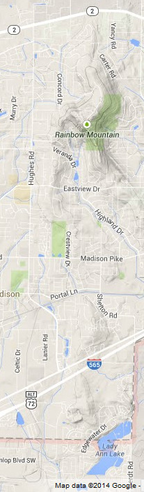
Rainbow Mountain - 1,145 ft
Obviously home to the Rainbow Mountain trails and several Madison neighborhoods, there are also a few caves on Rainbow Mountain including Rainbow Pit Cave. You can access the Rainbow Mountain Loop Trail via the neighborhood across from Discovery Middle School on Hughes Road.
Betts Mountain - 793 ft
Technically a summit not a mountain, Betts Mountain is located just north of Lady Ann Lake. It's also known as the lime quarry or just the "quarry". Scuba lessons were, at one time, offered within the quarry waters. Breland is currently developing near this area as part of the Town Madison retail center.
Capshaw (1,250 ft) and Little Burwell (1,063 ft) Mountains
If you look directly north from Rainbow Mountain, you'll see a point in the distance. About four miles off is Capshaw Mountain and it's smaller neighbor, Little Burwell Mountain. The unique location of Capshaw Mountain allow stations such as WZYP and WAY-FM to reach all the way north to Nashville and south to Birmingham.
| Next to Part Two (North Huntsville) |
Eric Adams
Eric has been an Editor for Huntsville Outdoors since 2012. His outdoor qualifications include: owning a canoe, enjoying the outdoors, and knowing how to type.
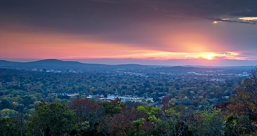
Mountains of Madison County Part Two
This is a continuation of our three-part Mountains of Madison County series. As promised, we continue with the North Huntsville area which offers some well-known plateaus including Chapman and Wade mountains. Downtown and south Huntsville to follow.
North Huntsville
Chapman Mountain - 1,213 ft
Home to many of Huntsville's most wealthy residents, Chapman Mountain boasts beautiful panoramic views of Huntsville. Chapman Mountain is just northwest of Monte Sano and is divided by US 72/Certain Gap (not to be confused with Blevins Gap and the Certain Trail) between Oakwood Avenue and Moores Mill Road.
Chapman Mountain is named after Alabama's 13th governor, Reuben Chapman. About half the mountain has been preserved by the Land Trust through multiple land purchases however, we're not aware of any publicly-accessible trails. The one slight caveat to that is trail #18 on this Monte Sano trail guide appears to encroach on Chapman Mountain with additional unmarked trails going even farther. It's our understanding that some residents of Hawks Ridge subdivision have plans to develop a trail that connects to the Monte Sano network via Land Trust property however, that trailhead would be private property most likely.
Chapman Mountain is also home to Panther Knob although it's probably debatable whether Panther Knob is its own entity. Strangely enough, Panther Knob Trail is not located on Panther Knob but actually on Logan's Point which is part of Monte Sano.
Brush Mountain - 935 ft
Brush Mountain appears to have no discernible history or current use. Civil War literature mentions a battle near Brush Mountain and also talks of a nearby Lost Mountain which is an apt name because there's no information on it. It's likely one of the two hills to the south of Brush Mountain that don't have names.
Wade (1,493 ft) & Smithers (1,138 ft) Mountains
Most Huntsvillians are aware of Wade Mountain thanks in large part to the Land Trust's development of public use trails that include easily accessible greenways and the more difficult and ominously-named Devil's Race Track Trail. The peak of the mountain is mostly sandy soil which contributes to an arid localized micro-climate allowing the occasional cactus to spring up.
Connected on Wade Mountain's eastern side, Smithers Mountain cradles the Mount Charron subdivision and old Valley View Golf Course. There's a proposed greenway that would utilize an abandoned railroad.
Drake Mountain - 1,204 ft
Just southwest of Wade Mountain, Drake Mountain's ugly south-facing scar can be seen for miles. The Drake Mountain Quarry was used by Alabama Concrete to mine rocks for construction projects in and around Huntsville. Mining petered out as Huntsville's population grew and encroached on the blasting zone.
The Mountain is named after Revolutionary War captain, John Drake. Star HB Farms offers horseback riding on Drake Mountain for about $30/hour.
Oakwood Mountain - 1,001 ft
Oakwood Mountain is located just north of Oakwood University and also was previously used as a quarry. Stones from the mountain helped construct some of the university's original buildings.
| Back to Part One (Madison City & Redstone) |
Next to Part Three (Downtown & South Huntsville) |
Eric Adams
Eric has been an Editor for Huntsville Outdoors since 2012. His outdoor qualifications include: owning a canoe, enjoying the outdoors, and knowing how to type.
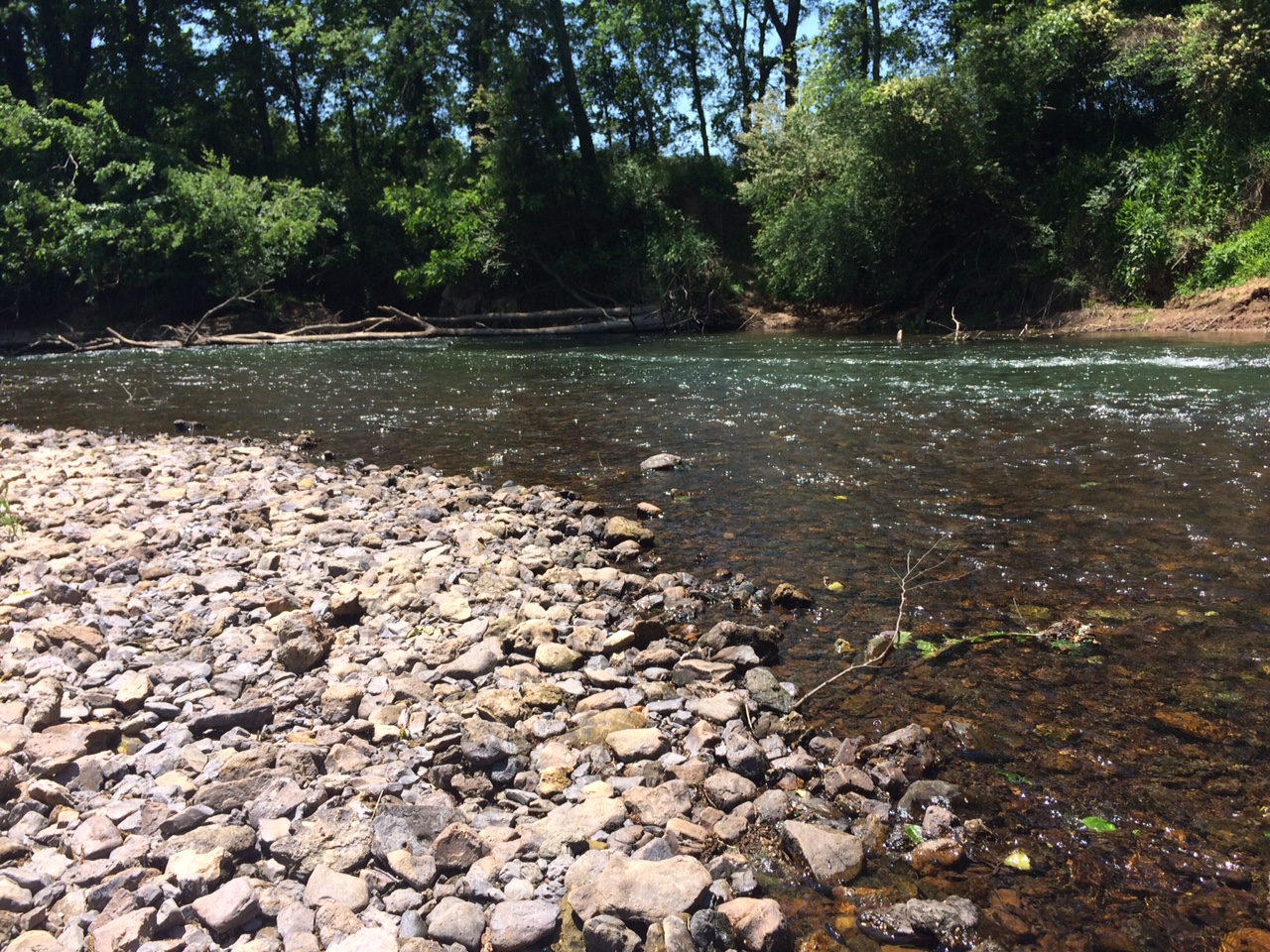
Put-ins and Take-outs
We thought we'd centralize our collection of river put-ins, take-outs, and other notable river locations into one place for your general use and enjoyment. The below maps cover the basics of the area: Flint River, Paint Rock, Indian Creek, and Sipsey. We hope to grow this list in the near future with maps for Bear Creek, Cahaba, Terrapin, and others.
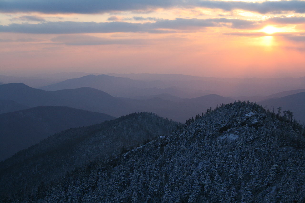
Smoky Mountains Backpacking: Trip Essentials
Davy Canupp
In the first of two articles, we preview an upcoming Huntsville Outdoors winter backpacking trip to the Great Smoky Mountains National Park. In this brief introductory piece, we want to share with our readers what we believe to be the essential gear items to bring on a two-night, cold-weather backpacking expedition. We have compiled this list both from our knowledge of the outdoors, from experience, and from some educated guess-work. We suspect there are many more experienced backpackers than ourselves among our readership, and we invite you to comment with suggested additions or alterations.
The Return of the American Alligator in Alabama
Although we aren't hunters here at Huntsville Outdoors, we are certainly gator watchers, and we were pretty interested to read this weekend about the 795-pound gator hauled in by a few Birmingham-area wranglers during the recent alligator hunting season.
About Huntsville Outdoors
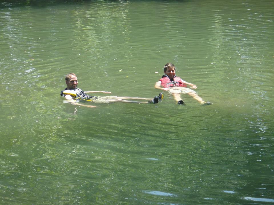
Welcome to Huntsville Outdoors! This website is intended to serve as a clearinghouse of information regarding entertaining outdoor activities and news in the Huntsville and North Alabama areas.
Huntsville Outdoors was conceived during a canoe-camping trip on the Flint River in 2012, but it's been a long time coming. Since approximately 2007, the founders of Huntsville Outdoors -- Davy and Eric -- have scoured the wilds (and not so wilds) of the Huntsville area, looking to investigate nature / kill time / find adventure. Naturally in the process we have accumulated a wealth of knowledge concerning fun outdoor activities in the Huntsville area.
Strangely, though, we've found that a good bit of this information is not publicly-available. We've heard so many rednecks describe how to get to obscure, off-the-map locations like Blackwell Swamp, Sublett Bluffs, and Rockhouse Cave that we thought we better write it down ourselves in plain English, lest we get confused because the old Jeep on the corner finally gets taken down off the blocks and we can't find our trailhead anymore. We thought it only fair if we share our veritable treasure maps with you.
We hope you enjoy what we have to offer, and we always encourage you to seek out your own outdoor adventures and share them with us.
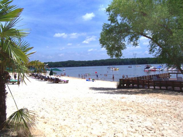
Top Swimming Holes in the Huntsville Area
Yesterday we received an email from a reader:
My wife and I are traveling to Huntsville at the end of August next month. Do you know of any places to go swimming near Huntsville? These may include lakes, rivers or springs. I look forward to hearing from you soon. Thank you.
-Hot & Dry in Huntsville
We absolutely understand the desire for swimming holes given Alabama's nearly extreme climate. Add to that the fact that public and private pools don't allow your best friend, Fido, to join in the fun. Well unfortunately for this reader, Huntsville proper doesn't offer too many places to swim although there are some but hopefully readers can come to the rescue with additional suggestions. The more picturesque locations are going to be 1-2 hours away but certainly conceivable for a day trip.
Close By
Joe Wheeler State Park
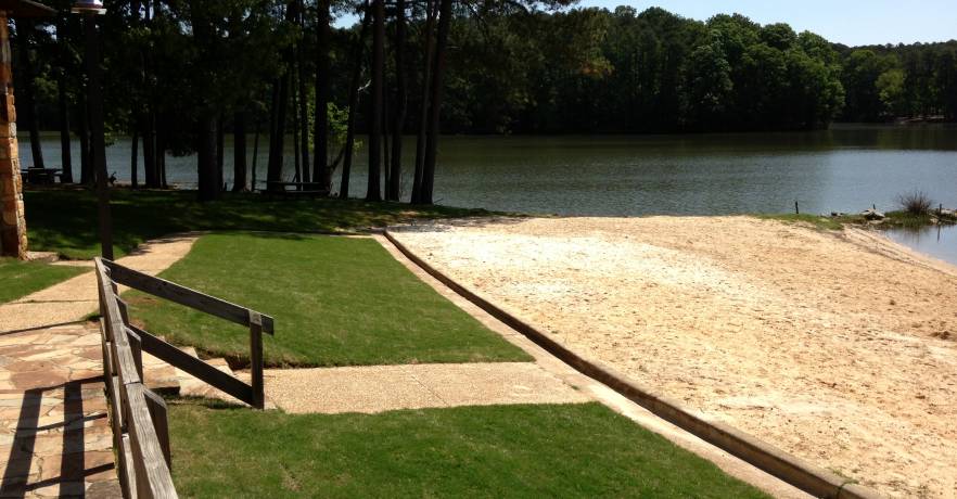
They've certainly got a nice marketing pitch:
You don’t have to go all the way to the coast to enjoy the sand, sun, and water. We have it here at Joe Wheeler State Park. The Beach Area is great for the kids and family. Soak up some sun rays, play in the sand, jump in the river to cool off, or have a picnic.
Cost: $4 for adults and $2 for kids. Easy access to restrooms and showers. Kayaking and SUP rentals available from Fort Hampton Outfitters onsite. No alcohol allowed.
Flamingo Point
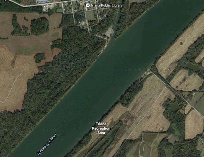
I actually discovered this place while canoeing from the Triana boat launch off Zierdt Road. There appeared to be a sandy beach across the river so off I went and eventually found a crowded beach. A nearby sunbather informed me of the beach's name. Google maps gives it two more names--Triana Recreation Area and Redneck Beach Campground. An older map refers to it as The Booger Hole.
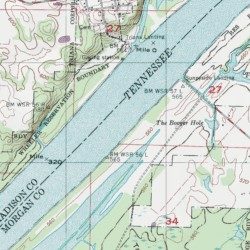
Tennessee River Bluffs
There are bluffs along parts of the Tennessee River that can be fun to explore. There have been some deaths recently so be careful. A popular spot is on the south side of the river close to Decatur. There's also some near Lacey's Spring.
Flint River
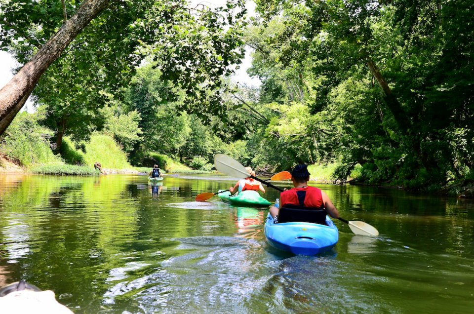
We've seen folks playing in the Flint River behind the Flint Primitive Baptist Church on Everett Road near Ryland Pike. Also at the concrete steps called Cherokee Landing within Hayes Nature Preserve. Several other road intersections are popular as well. The river can be fairly swift north of Hayes Nature Preserve so use caution.
North Alabama Canoe and Kayak (NACK) is also a great resource for float trips either by kayak or tube.
Pack a Lunch
Kinlock Falls - Bankhead National Forest
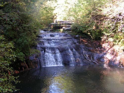
This would be about a 90-minute drive from Huntsville deep in Bankhead National Forest. The swift-moving water is chilly and the slope and smoothness of the rocks allow it to be used as a water slide.
Dismals Canyon - Phil Campbell
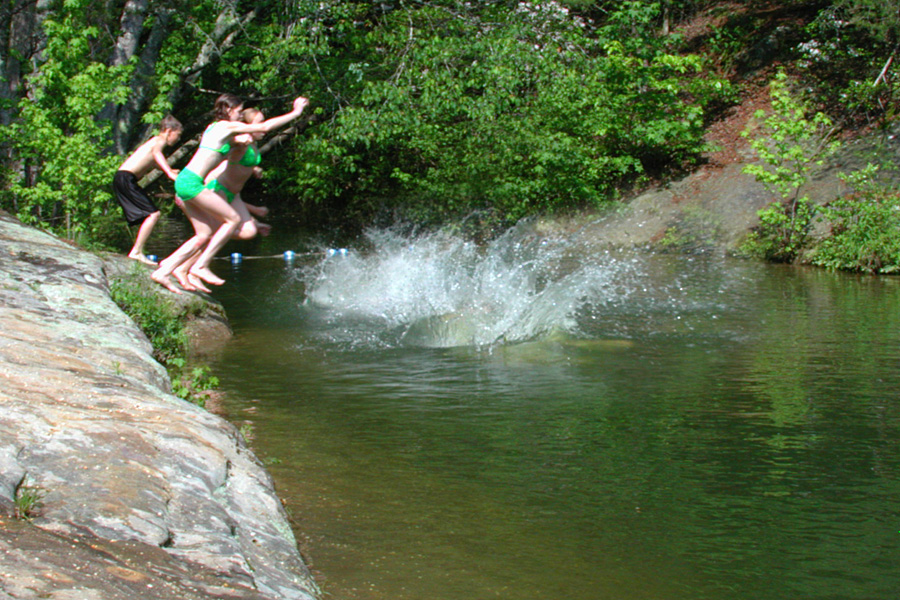
Swim in a natural pool carved out of solid rock by the rushing waters of Dismals Creek.
Combine it with a trip to Kinlock Falls which is only about 30 minutes from Dismals Canyon.
Little River Canyon - Ft. Payne
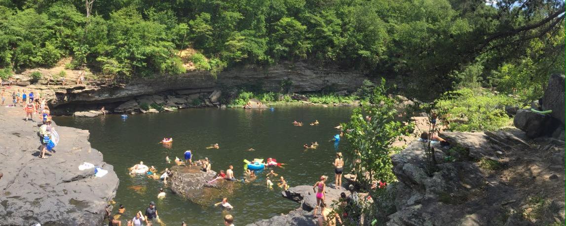
Martha's Falls, a.k.a. "the Hippie Hole", sits among bluffs and waterfalls and is surrounded by a lush forest. It's not exactly a secret swimming hole but it's definitely picturesque and will make for some amazing Instagram photos.
According to al.com, there's another spot with a rope swing called either Mills Hole or Upper Hole.
High Falls - Guntersville
The centerpiece of High Falls Park is the 35-feet waterfall. Formed by Town Creek, the falls span some 300 feet across at times.
Man Made
Point Mallard - Decatur
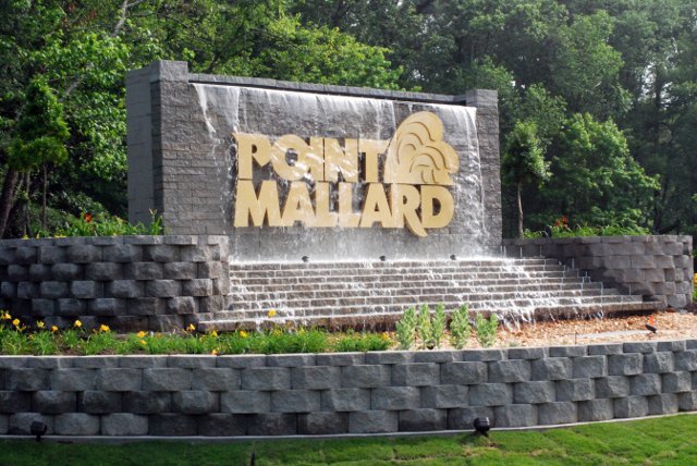
Nearly all Huntsville natives have fond childhood memories of Point Mallard. It's improved significantly since the 90s. Wave pool, lazy river...what's not to like?


Spring Valley Beach - Blountsville
This place is in the middle of nowhere. No. Where. You're driving through cornfields and then all of a sudden there's a clearing and a waterpark oasis appears. They've got several water rides plus what they claim is the largest pool in the southeast:
Our 2 acre pool offers fun for the entire family. Feel free to sit or grill out poolside, relax on a float in the pool, or slide down one of our four pool area slides.
They've got a very laid back philosophy. Bring your own grill, cooler, shade tent and spend the day by the gargantuan pool. It even made the Travel Channel's Extreme Waterparks.


All to Yourself
Rent "the largest slide in north Alabama" for a cool $600. It's 22 feet tall and 62 feet long. Better measure your backyard first.
Eric Adams
Eric has been an Editor for Huntsville Outdoors since 2012. His outdoor qualifications include: owning a canoe, enjoying the outdoors, and knowing how to type.
@huntsvilleoutdoors
All things outdoors in North Alabama.
![]()